

Arash Keissami of Nira shows that Nira is more than a fast viewer: it streams huge photogrammetry models, point clouds, Gaussian splats and design data to any device by rendering on cloud GPUs. Using customer projects, from a Florida building rescued by combining laser scanning with drone photos to a chapel mixing textured mesh and splats, Arash explains when each capture method works and previews support for Cesium tiles, STEP, IFC and collision meshes.
“If you're using a ten-year-old hundred dollar Chromebook, you'll get the same experience as if you're using a super high-end workstation.”
“Because we're not sending that data back to the client devices, that data's not sitting in your browser cache or in your GPU.”
“Like, if you wanna do very, very accurate measurements, maybe the Gaussian splat's not the best option.”
According to Arash, the data sits on fast NVMe drives next to powerful GPUs on Nira's servers, which render it in real time and stream it as pixels, so viewing a model is like watching a video.
Arash said there are no limits; Nira only suggests limits for textured meshes, still in the several billions of polygons, and Cesium support will raise that further.
Yes. Arash said OBJ, FBX and GLB already work alongside scans, and IFC support was expected within a few weeks of the talk.
Transcribed automatically (ElevenLabs Scribe) and lightly edited. It may contain small errors. Click a time to play the video from there.
Arash Keissami: How are you? Hello, everyone. I'm super excited to be here with you again. Uh, the title of my talk is Nira: Reality Capture Without Limits From Start to Finish. Um, most people know of Nira as just being a very powerful viewer, um, but I also want to talk about the versatility of Nira.
Arash Keissami: Um, for the next twenty minutes, I'll, uh, showcase some of our customer highlights, uh, give you a brief overview of Nira, and then give you a glimpse as to what's to come. Um, so we have a lot to get through, so let's just get started. Um, let me show you something here. Uh, what you're seeing now is not Nira. Uh, let me just make that perfectly clear.
Arash Keissami: Uh, this is what a lot of our customers are used to experiencing prior to using Nira. Um, it's-- notice how slow the model loads. Uh, this is a big problem with reality capture data. Uh, it's just big, and inherently it's just slow to load, um, uh, at least when you're not using Nira. Um, I screen captured this video just yesterday from my hotel room.
Arash Keissami: Uh, and it just, you know, hotel rooms don't have the best conditions. Uh, but I also did all the screen captures in Nira in the same hotel room. So you get a, a nice direct comparison of what you get from even not perfect internet conditions. Uh, by the way, this model was shared with me by Martin Weider. Uh, Martin is quite prolific on social media.
Arash Keissami: You've probably seen him on LinkedIn and YouTube. Uh, he was supposed to be here today, but it sounds like he's gonna be here later today, uh, so he's missing this. Uh, but thank you, Martin. Um, I asked Martin for the photos 'cause when I saw this model, I was convinced we could do better. Um, and he, uh, he shared it with me.
Arash Keissami: Um, by the way, another problem you'll notice besides the loading is the holes in the model. Uh, so I feel like we could do better on that as well. Um, so here's the same model, this time in Nira. So the same data source, same photos, uh, this time processed using, uh, desktop photogrammetry software. I'll talk a little bit about some of the different options you have for, for desktop photogrammetry.
Arash Keissami: But inherently, you just get typically much better models. Now, desktop photogrammetry doesn't inherently mean or it's not immune to having photogrammetry issues like holes and whatnot. But when you do have those issues, uh, typically, uh, you can resolve those. Um, in this instance, this model was really well reconstructed right out of the bat. No real, uh, changes at, at all to this model.
Arash Keissami: Um, and it's got more than enough detail for doing virtual inspection. And again, you get this level of quality on any device. Um, I should just remind you that cloud processing in general doesn't inherently mean it's going to give you bad models. Um, but again, the benefit to desktop photogrammetry is that you can fix things as you need to. Um, so this next slide talks a little bit about that, which is this model was much better, but it's not perfect.
Arash Keissami: Um, you can see there are floating tree branches dangling on the edges. Uh, for those that don't typically do photogrammetry processing, uh, the general workflow is you bring in photos or any type of capture device or capture source, and then you create a region of interest box, uh, or a reconstruction box, and whatever's within that box will be included. So if you got tree branches coming in, that will be included. Um, there was a, a example of a car that was parked in the driveway. Part, part of the photos included that car, part of it wasn't, so it was a ghost of a car.
Arash Keissami: Here you can see there's a cross, and it looks like there's snow on that, but it's really just the environment and, and the skyline mixed in with the clouds that un- unfortunately contributed to the, to the mesh as well. The, the good news is we can fix all these issues. You can also see on, on this facade here, we have, uh, a little bit of, uh, shadows from the tree branches. Easy to fix, uh, with desktop photogrammetry software. You'll also notice that I'm more or less removing all the trees.
Arash Keissami: Um, might not be necessary to remove all of them because you want to keep some context. But in this example, if we're doing virtual inspection, it's nice to remove those trees so the person that's doing that virtual inspection or, or the one that wants to annotate or measure on that model doesn't have to navigate around tree branches to get to the, to the data they want to see. And we also removed a-- this, the, uh, the ghosting on the car. That was a very easy thing to do. And finally, the cross up top looks much, much better.
Arash Keissami: Now, if you wanted to, um, it, bring in the trees, you can certainly have done that because typically trees and thin surfaces don't reconstruct well with photogrammetry. You could reprocess that using Gaussian splats, uh, and then bring in the trees as Gaussian splats and mix and merge data within Nira. That's again, the, what I wanted to communicate with this talk, which is the, the versatility that Nira provides. Um, for those that don't know Nira, let me just give you like a five-minute overview of what Nira is. Uh, for the most part, Nira just removes the barrier of getting access to big data.
Arash Keissami: So here is a four hundred gigabyte point cloud dataset. Um, on the left you have Nira. Yeah. So that's our left here. And on the right you have Potree.
Arash Keissami: Um, Potree is the most common, uh, point cloud viewing technology that's used, uh, essentially by everyone. Um, we don't use Potree, so we have our own point cloud viewing technology. Um, and what you get is significantly better viewing of that data. Um, and, and I'll talk a little bit more how that works. But another benefit you get is you don't have to tinker with quality settings.
Arash Keissami: Re- regardless of whatever device you have, you'll get the exact same experience. If you're using a ten-year-old hundred dollar Chromebook, you'll get the same experience as if you're using a super high-end workstation. You don't even have to have a GPU at all. So I'll go over l- just briefly about just how that works again. You upload data to cloud, typically like you do with most services.
Arash Keissami: The key difference is that our servers have GPUs in them. So when you're accessing that data, whether it's a point cloud, a texture mesh, a Gaussian splat, or a wide variety of other types of reality capture data, or even just design data or BIM data, uh, you have access to a very powerful, pretty much the top-of-the-line GPU you can get, um, in the cloud available to you at, at a moment's notice. Um, so again, no need for having a GPU. This gives you a little bit of a glimpse as to how our technology difference differs. So you can see on, on the left here, we have the, um, typical workflow.
Arash Keissami: Again, it's the same with other platforms. You have the data sitting on your storage device. You upload it to the cloud. The key difference again is that once you start to get to the middle, we have a GPU on our servers, and we're accessing that data on very, very fast storage, you know, very fast NVMe drives. So when we're having to read gigabytes and, or terabytes, quite frankly, of data, you're, you're not pulling that data across an internet wire or a poor Wi-Fi connection.
Arash Keissami: You're pulling that data from an NVMe drive, which is at gigabyte speeds, onto a very powerful GPU. And then we render it in real time and stream it as pixels. So you're just basically getting a video, and that's why it becomes so accessible. Because if you can view something on your phone or mobile device, if you can view a YouTube video or a Netflix show, then you can, you can get access to your biggest photogrammetry models or reality capture data. Um, and then this kind of bullet points the key differences.
Arash Keissami: Um, you can see highest visual quality all the time, regardless of the device. It's nice and consistent. There are no quality settings. You don't have to press, you know, high quality. You don't have to adjust the budget of points or any of those types of details.
Arash Keissami: It's accessible on every device. There's zero GPU required. It's kind of strange to imagine there are no GPUs on any devices these days, but that happens. Um, and, uh, you know, you have these little client devices that you see at banks or other places, and they just have no GPUs. Um, and finally, uh, Nira is ultra-secure.
Arash Keissami: It's the most secure platform of all. Um, and the key aspect to that is just inherent with our technology. Because we're not sending that data back to the client devices, that data's not sitting in your browser cache or in your GPU. Uh, a lot of these other platforms, they tout these certifications. Um, it's quite frankly, uh, a little bit of bullshit because if you get-- you send me the link to any of the, the reality capture datas, regardless of whatever certifications it is, it's extremely trivial, uh, to, to scrape or rip that data and basically have it permanently.
Arash Keissami: Um, with Nira, that's impossible because we're never sending that data. It's just, it's sitting on our servers and staying on our servers. Um, I really wanna talk a little bit about what our customers use for how they capture the data. Uh, again, speaking to the versatility of Nira, a lot of times photos alone don't do the work you need. So a lot of our customers use a combination of your typical cameras, um, of course, uh, different payloads attached to drones and even, you know, LiDAR devices.
Arash Keissami: Uh, a lot of pop-- A lot of our customers, uh, like to use laser scanners, you know, mobile laser scanners, terrestrial laser scanners. Um, and some of our customers are using some very exotic equipment. Uh, so let me zip through the next one. Um, so you can see there's these, uh, these boats. I've never used one myself, but they look really cool.
Arash Keissami: One of our customers uses these robots that they actually develop themselves, and they scan the surfaces of various infrastructure. Um, and they, you know, they, uh, they sca-- they crawl around, and they're measuring a wide variety of things, and they're pretty, pretty impressive. Uh, then we got these, these walking robots. Um, so really cool stuff. This is the, the most popular photogrammetry software that most of our customers use.
Arash Keissami: Not just photogrammetry, but just reality data software. Um, RealityScan's right at the top. Um, then of course, DJI Terra is becoming very popular in a wide variety of them. There's a few that are becoming very popular for, for Gaussian splats, um, so that's listed here as well. Um, and here is an example of a customer's dataset.
Arash Keissami: A lot of times when they upload something to Nira, the quality doesn't always look great, not because of the viewing, but because of how it was reconstructed. Uh, the challenge is that sometimes some sites just don't reconstruct well. Uh, this was a little bit strange because it was well-captured. They had a lot of photos, but because there was a lot of windows, a lot of shiny surfaces, and it was a white structure, it just didn't work out that well. Um, and they, they also weren't able to capture certain areas because there was a lot of pedestrian walkthrough and stuff like that, so it just...
Arash Keissami: You know, they weren't able to get very low to the ground. Uh, this building was in Florida or was on the coast of Florida. So I actually asked, uh, uh, someone I know at Riegl, they make some very powerful scanners, if they were able to join or go on site and scan the building as well. Um, and that way we would get the point cloud, which is inherently much more accurate and, and reliable. Um, or these laser scanners are more reliable with capturing.
Arash Keissami: And then we would combine the point cloud with the drone photos to produce a more reliable and more accurate model. Uh, the resulting model looked a thousand times better. Um, it's, uh... The good news is with the laser scanner, we can position them much more r- safely anywhere. We don't have to worry about anyone running into a drone or anything like that.
Arash Keissami: So we're able to get the, the front entrance much better well-captured or a lot better captured. We were able to, uh, even send the laser scanner through the garage. So we got the garage captured exclusively through the laser scanner. And again, we were able to mix, uh, both the laser scanner with the, the drone photos and produce a much, much better model. We also...
Arash Keissami: As-- Uh, another benefit of the laser scanner is you get these bubble views, and you can just navigate, uh, to each of these bubble views, get a nice kinda walkthrough. There's our Riegl friend here. Um, and, uh, I, I will mention there was one aspect to this model that didn't, uh, get reconstructed very well and that there-- the top or the roof of this, this, uh, building had, uh, basically a glass rail or glass wall, uh, keeping people from falling off. Um, and I can show you that when we, when we pull up the photos here. You'll see, uh, here we have this glass.
Arash Keissami: And with the laser scanner and the drone photos, unfortunately, neither one of them was able to capture. It's just too clear or whatever the case may be, and there are certain circumstances where it just doesn't work. Again, because of the versatility of Nira, we were just able to reconstruct that just using just traditional 3D modeling software. So you can do this in, I'm pretty sure, Revit. I, I ended up doing this in Maya, uh, which is just a 3D modeling tool.
Arash Keissami: Um, but, uh, you can do this in Blender, pretty much any, any tool that can create a very basic shape. This was done in like five minutes. Um, again, is it 100% necessary? Not all the time. But if you really want to present your models in the best case, an extra five minutes can go a long way.
Arash Keissami: And now we're able to, uh, at least give you some visualization of the, the entire site without anything significantly missing. Um, so by the way, we did try to reconstruct this as a Gaussian splat. Um, we thought... You know, it did a much better job in some areas, but unfortunately, the Gaussian splat did introduce some artifacts. Uh, Gaussian splats are amazing.
Arash Keissami: They do a phenomenal job, and I'll show some other examples of when Gaussian splats are really applicable. But for this one in particular, again, because we were mostly doing facade captures with the drone, uh, if you don't have those angles, they don't work out so well. And also, you can see there was some window, uh, washing stuff in, on the side there, and removing that type of data is a little bit harder to, um, to, to do with Gaussian splats. Here's another, uh, site that was captured. Uh, this one was reconstructed in, in RealityScan.
Arash Keissami: Um, and it was a-- it's a combination of an exterior and interior. A lot of our customers like to do both. Um, and so they'll use a combination of drone photos, which this used. This also had a terrestrial laser scan, uh, a 360 photo camera. Um, and also the interior was alm-almost exclusively captured using a Samsung, uh, smartphone.
Arash Keissami: Um, and so y- again, you can bring in all these different types of capture devices into the different various photogrammetry softwares and create a nice seamless model, uh, like this. Um, as I navigate through this particular site, you'll see the level of detail. Again, this was all just through the smartphone. Um, the, uh, level of quality that you get just on, you know, these paintings. Uh, this one part in particular, um, came out quite nicely.
Arash Keissami: Uh, we did also create a Gaussian splat, which I'll show in a minute. And so there are some, some circumstances where the Gaussian splat looks, looks better, and there's some circumstances where the Gaussian splat didn't match the quality that you get with the textured mesh. Um, as I navigate through this, uh, chapel here, we can see there's, uh, some candles here, uh, which-- where you ca-- It's not obvious that they're candles, but once I pull up the photos here, you'll see, uh, the candles weren't really well reconstructed. Um, and that's typical. Like, cer-certain surfaces that are translucent or, uh, or super bright, um, they're just gonna give you artifacts like this.
Arash Keissami: Um, you could try to replicate or remodel it sort of like I did with the, the glass, uh, railing, but that's probably a little bit more work than, than you would want to do. And then, of course, there are some things that are ultra, ultra clear, like these vases on the altar here, uh, that completely, you know, pretty much all you got was the shadow of the, of the vase there. Um, so didn't do a great job. So if we were to go to the next slide, I'll show you. This is now the Gaussian splat, so you'll see the same site reconstructed as a Gaussian splat.
Arash Keissami: And if we wanted to, we could bring in the Gaussian splat and replace the texture mesh. So we-- If the outier-- if the exterior turned out perfectly with the ex-- the texture mesh, we can mix and match. So you can see here, um, it really just comes down to what Thomas and, and the guys said for the, for the Gaussian s- uh, splat talk. It really just comes down to your purpose. Like, if you wanna do very, very accurate measurements, maybe the Gaussian splat's not the best option.
Arash Keissami: But if you wanted to replicate all the different elements, uh, this, in this instance, the Gaussian splat really came in. And you can see I was actually pleasantly surprised by how well that reconstructed. Uh, let's see what else. Um, here I just mentioned we sc- also captured the site with, uh, a 360 camera and, and also a terrestrial laser scanner. So you can see, you can just jump around and see the bubble views and turn them on or off.
Arash Keissami: We also did capture or reconstruct the exterior as a Gaussian splat just to see what that would look like. Um, I will mention that Nira supports, uh, all assets, uh, with georeferencing. So if your photogrammetry or your, your Gaussian splat, um, tool is able to reconstruct the model as in, in a-- with georeference coordinates, it'll come in with georeference coordinates. Uh, you also notice the, uh, those little pins that keep the birds off. Um, those really, really came m-much better than what you would typically see with a photogrammetry model.
Arash Keissami: Um, there's a little GCP target on the ground. I just sampled the coordinates on that, um, and then I just dropped this into Google Maps. Um, by the way, I recorded all this just in the last two days, uh, from my hotel here in Prague. So, um, you can see here, uh, let's just grab the, the coordinates, and I'm gonna paste it in. And this is just to give you, uh, just the, a, a glimpse as to how the, um, georeference coordinates are able to be referenced right within Google Maps.
Arash Keissami: So once it pops up, you'll see it found the exact location that we, we identified inside of Real-- uh, Nira. I, you know... So not just georeferencing, we also support pretty much all aspects of Gaussian splat. So we have, like, this photo inspection workflow. So if you wanted to reference the original photos, you can do that.
Arash Keissami: Um, and that works with Gaussian splats. This is another georeference model with the camera coordinates aligned with it. So you can see, you can click on any part of the Geo-- uh, the Gaussian splat, and then finally get to see the original source photos. Uh, Gaussian splats do a phenomenal job with reconstructing the model, but they sometimes miss certain things, and so having access to the source photos really can help with identifying exactly what the issues are. Um, so wanna give you a quick glimpse as to what's coming.
Arash Keissami: Um, so our mantra for probably the next year is just continuously adding better support for a wide variety of different media and data. Uh, so we're adding support for Cesium Tiles, uh, STEP files, uh, IFC data. Um, and also we have some improvements we're making to-towards our user experience, and, and one of them is, uh, adding support for collision meshes. So these are two exact datasets, um, one on Le-- Nira on the left, the other one on the right. Uh, essentially, the one on the right is using a tr-typical web-based Cesium-type viewer.
Arash Keissami: You can see how slow it takes to load. It can t- sometimes take, uh, you know, upwards of sometimes several minutes to fully load all the detail. Uh, Cesium technology is quite nice. It's just kind of being held back by web viewing. Um, so when you're having to pull all that data through a web browser or through the internet, again, sometimes not super reliable or fast internet, um, it can be slow.
Arash Keissami: And even if you have the fastest internet connection, you're also sometimes limited by what the server you're connecting to is willing to serve. Um, so inevitably, you're constantly doing this waiting. You're, you're going to the site or going to a specific location. You don't even know for sure if you're even viewing the highest level of detail, and you essentially want the most detail so you can make the most accurate measurements. Um, and again, in- in- inevitably, as you start to navigate through the model, it eventually will crash.
Arash Keissami: Like, I've never had a circumstance where, especially on mobile devices, where I'm navigating within a couple minutes, it starts to not work. Um, this is a- another example of mixing in a variety of different data. So this is a Gaussian splat. This was captured using the XGRIDS, uh, L2 Pro. Um, and again, we have Uh, Gaussian splats.
Arash Keissami: We have the photos. Uh, we have panoramic images. Um, the panoramics came from the L2 Pro, um, and we'll be able to see that. But here's an example of, you know, with the L2 Pro, the Gaussian splats didn't reconstruct or didn't represent the, some of the details that you can see from the photos. Um, but it's, uh, it's, it's still there.
Arash Keissami: And then we can, uh, navigate through here. And now I'm switching to showing all the different panoramics. Of course, because it's a mobile scan, you've got a lot of bubbles. Um, and then you can also switch to your point cloud. So again, uh, if you wanted to do more accurate measurements, maybe the point cloud was the option.
Arash Keissami: You can certainly do measurements on Gaussian splats, but having access to the, uh, the point cloud makes, makes it a little bit more, I guess, accurate or more reliable. Here is a STEP file. So you can see, I just... You can download these STEP files directly from DJI, and you can get a really nice, accurate model, um, and, and mix it in with your data. Uh, let's see.
Arash Keissami: Next, uh, here's IFC. So this is on the horizon. Probably within the next month, you'll be able to upload your biggest, highest resolution IFC models, um, and again, mix them in with your reality data or just view them in isolation. Um, so have a 60,000-seat stadium, and you wanna view this on your phone, that's all possible. Uh, finally, uh, this was sent to me yesterday.
Arash Keissami: Um, our, one of our graphic engineers, uh, is wrapping up his support for collision meshes. Um, so whether it's a mesh or a Gaussian splat or a point cloud, now you'll be able to navigate through your sites, uh, in a more intuitive way. So in addition to being able to view your assets at the highest level of quality, we also wanna make it as easy as possible. Uh, for probably most of us in this room, 3D is kind of second nature, but there's a lot of people, especially those that are doing, you know, uh, inspection work, that are not as comfortable with 3D. Um, and you can see here now, I can just walk around.
Arash Keissami: He maybe jumped around a little bit too much here. Um, but you can see he's just hopping around, and you can pretty much get access to any part of your model just by hopping around. Probably not the best idea to hop around a, a chapel, but that's what we did here. Um, and that's it. So thank you for that.
Host: Arash, wonderful presentation.
Arash Keissami: Thank you.
Host: Uh, plenty of questions, so let's tackle them one by one. Is it possible to import the building model into Nira along with the scan of that model?
Arash Keissami: Yes. And so you can, as I demonstrated, you can do that through IFC in probably another couple weeks. Um, but if you have other file formats like O- OBJ or FBX or, uh, GLB, those already work, so you can mix and match all you want.
Host: Awesome. Uh, specific question about that cell tower. Very detailed capture. So what was the workflow on that tower?
Arash Keissami: So the, the workflow is pretty much the same as what you're probably already used to. You c- ... That one was captured using 3D scan, which is a, a technology built into some of the, the newer, uh, DJI drones. Um, and it was captured in a kind of like a cylindrical pattern, and then you can just bring that into. Some of the different photogrammetry softwares already have support for Gaussian splats, and some you can augment through, uh...
Arash Keissami: So for example, you can bring the, the photos, align them in RealityScan, bring that camera alignment data, um, into a pho- a Gaussian splat tool, and then create the Gaussian splat. And then bring the alignment data with the Gaussian splat into Nira, and they kind of work together. And they can be georeferenced. So that's one of the nice things about RealityScan, is it kind of already works with, uh, a variety of different software applications.
Host: Sweet. Uh, two words. Prices, please.
Arash Keissami: So we try to make Nira as, uh, accessible as possible, not just with viewing the data, but also just making it as affordable as possible. Um, so our lowest tier price starts at $19 or $19.99, I think it is, or $19, I don't know. N- Forget the 99. Um, and the business, uh, the strategy with our, with our pricing is the same across every tier.
Arash Keissami: You, you get essentially some storage, and as you start to use it more, you basically pay incrementally more. So you don't go from $19 to $100. You go from $19 to, like, $23. So as you start to add more models to your plan, you can incrementally upgrade your storage.
Host: Mm-hmm. Uh, do you have any limits on the size of, uh, point clouds that can be uploaded to the platform?
Arash Keissami: No limits at all. So there's no limits across the board on anything. Um, the one limit we have always suggested was, uh, maybe not go, uh, as high with the, with the polygons, but that's one of the benefits of adding Cesium support, which is now we'll be able to go even higher. Now, when I say we suggest certain limits on point cl- or on, on, on texture meshes, that's still in the several billion. Uh, but what we have noticed is that some of our customers are doing astronomical-sized datasets, you know, in the many billions, like city scale or even bigger.
Arash Keissami: And so we needed to have a technology that could better, you know, retrieve and, and fetch that data and then also release that data so that we can not have everything sitting in RAM. As powerful as our servers are, which they are the fastest, cheapest you can get, there's still a limit when you're doing things in a more brute force way.
Host: Arash, thank you so much.
Arash Keissami: Thank you.
Host: Ladies and gentlemen, let's give it up for Arash Keissami.
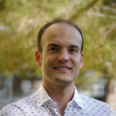

Co-Founder @ Nira.app
At Nira.app, our team is revolutionizing the organization and collaboration of large digital assets, leveraging over two decades of experience. My expertise lies in creating sophisticated platforms that cater to the complex needs of site inspection, media review, and data analysis.


