
Arkadiusz Szadkowski of Esri explains how reality mapping (meshes, point clouds, orthophotos and Gaussian splats) becomes the foundational layer of GIS-based digital twins, and why a digital twin is a journey rather than a purchase. Arkadiusz walks through environmental, urban, indoor and network twins, shows AI mapping thousands of trees in minutes and previews terrestrial Gaussian splats in ArcGIS Reality.
“I like to say this is not a transaction. It's a journey.”
“the reality mapping at Esri perspective, it's a realistic base map for the modern 3D GIS future.”
“Gaussian splats are superior in thin structures reconstructions and the reflective surfaces like glass”
According to Arkadiusz Szadkowski, updates are up to the customer, but cities such as Prague or Vilnius typically fly a high-resolution aerial campaign every two years and use drone programs for local updates.
Arkadiusz said meshes are watertight and perform better for 3D analysis like wind or flood simulation, while Gaussian splats are better for thin structures and reflective surfaces, and ArcGIS users can export and work with both.
According to Arkadiusz, the city wanted to correlate overheating areas with population data to decide where to place hydration stations, shading and trees to fight urban heat islands.
Transcribed automatically (ElevenLabs Scribe) and lightly edited. It may contain small errors. Click a time to play the video from there.
Arkadiusz Szadkowski: Thank you. Thank you very much. I think we have a video first. Okay, did you recognize? We were in Prague, thanks to the Institute of Planning and Development from Prague City.
Arkadiusz Szadkowski: So thank you very much for sharing this video of us, one of our customers. My name is Arkadiusz, and I have the pleasure to speak to you today about reality mapping, the journey from reality mapping to digital twins, and a little bit about Esri, who we are and what we do. Uh, I'd like to start with the perspective. There is more cameras in this room than people. There is definitely more devices in this room than people.
Arkadiusz Szadkowski: All of these devices sends data to and from cloud, and most of these devices register position and location. So we live in the world where this data needs to be managed. This is a huge volume of the data that is more and more important, and where the science of location and location is becomes a crucial part of it. And we at Esri, we happen to develop a software and enterprise platform that is addressing this for many, many decades already. Our slogan is the science of where.
Arkadiusz Szadkowski: This is how we are trying to aggregate different type of the users around the same system of record system, of insights and system of engagement, because there are different type of the users who needs different type of access for the same data. So what is the GIS? A GIS is which stands for the geographic information system. We put all of this data together into the sy- into the aggregated data layers, where we are abstracting or visualizing or recreating the world in order to help you take the decisions, put the, put them at work, and from measurements, from data collections, all the way to the action. So we do this with ArcGIS platform, that is, can be deployed as a SaaS, PaaS or as an enterprise device.
Arkadiusz Szadkowski: It has multiple capabilities, applications, and it's organized around different type of the user types, from the creator all the way to the professional plus, that's many of you are. And I'm talking about this because ArcGIS is integrating many different digital twins, and I will show you a lot of those examples in a moment and how we integrate this. And we always look on this from the perspective of what is the outcome focus? What is the u- end user needs and capabilities that he wants to achieve with our technology and with the imagery and the reality capture data that you are collecting? But before that, I would like to share with you the, the way we understand the digital twin as a terminology and how we are approaching this market.
Arkadiusz Szadkowski: So we often very hear that you can buy yourself a digital twin. I like to say this is not a transaction. It's a journey. It's a journey that you are starting with building the descriptive layer. What Thomas presented was very beautiful, and that was...
Arkadiusz Szadkowski: Th-this is where he started. He started recreating the reality. We call it a descriptive informative layer. This is where you create a digital model, a background that is so important to build applications and solutions on top of that. The next level is informative layer.
Arkadiusz Szadkowski: This is where you collect sensors, IoT information. This is where you pull the information from your descriptive layer. And only then you are able to transform truly into the digital twin, where you can run the simulations, when you can run scenario-based modeling. This is where you can do the forecasting. This is where your, your twin starts to be predictive, and hopefully in the future, autonomous.
Arkadiusz Szadkowski: I have not seen yet those, but we are on this journey. And it all starts very often with imagery and remote sense data, so imagery and laser scanning on the journey to the living digital twins, as we like to call it. When we work, and I work with this industry, I find myself very often on the intersections of three key domains that we need to respect, that on-- there's different, different domains that are coming together. It's of course GIS, but it's also entire BIM world, so building information modeling, and there is asset performance management. Most of you works with at least one of those domain.
Arkadiusz Szadkowski: You either create the GIS layers or create the BIM models, or you work with asset inspections, asset management. And all of this has to be, be put together into the one integrated platform. And our role with the reality mapping is to create a layer that describes and creates the background and describes how the world actually looks like before you start putting all of these layers on top of it. This is what reality mapping stands for, and this is why we call it also reality mapping, because we want to push it beyond the capturing the data, but also bringing it closer to the end users and the platforms. For reality mapping, we have an ArcGIS Reality application that has different applications from specifically for either drones or, uh, aerial survey, uh, within ArcGIS Pro or outside ArcGIS Pro.
Arkadiusz Szadkowski: But all of those use the same engine and produce the same type of layers. Layers that you will see today very often in, in many of the presentations. Of course, the, right now the trending is the Gaussian splats layer, but we can also produce the 3D mesh models, short auto DSM models, point clouds. And those are very important layers when you want to work and s- and stress this data to get more of the features out of it. I will show some of the examples in a moment.
Arkadiusz Szadkowski: So when I try to describe to someone what is my job actually at Esri is to bring this world of the reality capture and all of you who are working either with the hardware data capture or the service providers and create for you an, a bridge to bring these different layers of the reality mapping into the GIS world. And we represent over ten million ArcGIS Pro users and four hundred thousand organizations around the world that is hungry for those data. And they will be more and more hungry with the rise of AI, because as you very know, very well know, AI understands very well imagery, and it can automate and operate on the imagery in a very smooth way. So the reality mapping at Esri perspective, it's a realistic base map for the modern 3D GIS future. It's a, it's a foundational layer for all the other analysis that our users are performing.
Arkadiusz Szadkowski: Either they overlay features, point features, visualization, simulations on top of this. This is the foundational layer. And by foundational, I like to visualize this in this perspective. We live in the era where it's not anymore about building one thing well. It's about building these multiple foundational layers interconnected, where we have reality mapping that is capturing the world.
Arkadiusz Szadkowski: You have an enterprise platform with access to the different data, connectors to open data, and AI, a layer that is emerging. And in my opinion, it's very important to separate the interfaces on the very last level, on the top level. And to prove that, I will make one exercise. I will make you uncomfortable for a moment. Please pick up your phone, unlock them, and go to the home screen and exchange the phone with someone who sits next to you.
Arkadiusz Szadkowski: Please. And just don't go to the private messages, but interact, interact with their interfaces. Does it feel like a foreign country to you? And it's same technology behind it, same cloud, very often the same applications, and same, uh, same different, uh, same software behind it. But the interface is completely different because we all are pers-- it has personalized to your needs.
Arkadiusz Szadkowski: With the agentic and automation future, it will become more and more possible to personalize the interface for the end user to the his personal needs. And you are actually doing this right now with your phones. Okay. A lot of this excited people, please bring, give back the phones to someone. So...
Arkadiusz Szadkowski: And when we, when I mentioned this, that we are thinking from the digital twins from the outcome driven perspective, we really are looking from the perspective how our end users are using this. So not from the data capture, why and how they are capturing, but what is actually the purpose of the end, end user for this digital twin. And we segregate this couple of the like key segments or key use cases for our users to operate with the data. And I will show you a couple of those examples in a moment, uh, to walk through how the reality mapping is actually creating this foundational layer for those digital twin. The first one is an environmental twin.
Arkadiusz Szadkowski: We are in the city of Phoenix. Uh, aerial survey has been performed with the two different aerial survey sensors. Simultaneous data acquisitions of RGB, so visual spectrum, and the thermal camera was applied on top. Multiple layers was created at the large scale. You see the 3D mesh, you will see the thermal mesh, you will see the Gaussian splat layer.
Arkadiusz Szadkowski: This is feeding the entire GIS system. It's feeding an AI automation for building extraction, vegetation extractions, for 3D analysis, shadow analysis, multiple 3D analysis for the city to fight urban heat islands. We are... And what one of the conclusions was like, it's, it's good to have a golf subscriptions if it's a hot day in Phoenix, because it's the coldest place in the city. The next example that I presented last year, but I like to come back to it, it is the city of Oslo.
Arkadiusz Szadkowski: City of Oslo is going through the development of multiple new buildings being built in the city center. And of course, this raised a lot of concerns among the citizens and become the political discussions, how this will affect the quality of life. So they use the 3D mesh, and they put on top of the news new planned development cities, analyze the noise distribution, pollution, wind analysis, all of those, those kind of 3D analysis that you want to do to check how the quality of life will change with the new buildings being developed. So as is versus as designed in the digital twin world, even the solar po- solar analysis. Now we go into the little bit smaller scale, and we go indoors.
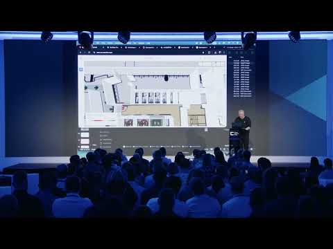
Arkadiusz Szadkowski: What you see is the 3D mesh combined with the indoor scans from the point cloud and then converted into the BIM data. Very typical workflow for many of you, where you do the indoor scans, you build the BIM models indoors to, for the asset inspections, asset inventory, and you create a 3D mesh envelope on top of that. So we have a situation awareness on the outside and complete an architectural survey grade quality inside of the building. Everything what we are visualizing right now is in our 3D viewer, scene viewer, web browser-based. So we are interacting with three different type of the layers that I mentioned on the very beginning in one interface connected to the GIS, uh, system of record.
Arkadiusz Szadkowski: And we've seen a lot of the XR technology and game engine technology. So what we are right now doing, we are placing a BIM model on re-- on the mesh model, where we replace a part of the mesh with the BIM model, analyzing 3D, and we are going into the XR experience. We also have an XR viewer that it can be powered by Unreal Engine or Unity Engine. We have an SDK for both. And you are able to use this with the headla- headset glasses or the augmented reality and experience this reality model as is and the planned design model over the, uh, over the construction area.
Arkadiusz Szadkowski: That takes me to the network twin. So this is where we really need to go into the detail, where you really want to inspect the asset quality. We are on the substations from, uh, courtesy of Network Waitaki, where right now we are going do the fly through for the Gaussian splats, and we are right now in ArcGIS Pro. User is able to interact with it, measure, annotate, clip, segment, and share. And I can publish this to web and post this into the web browser.
Arkadiusz Szadkowski: Right now, we are in the web browser experience where I can do the same, measurement, annotating, segmenting, and, and interact it with. Interact with the, across the different users, because it's an online platform that you are able to exchange and collaborate with your colleagues at work. So another example comes from the San Francisco Airport. This is where a lot data is connected into the one very complex and very high density digital twin. You see the 3D mesh, you will see a BIM data, you will see points of interest in the GIS data, and you will see also indoor scans across.
Arkadiusz Szadkowski: Very high density, as I mentioned, digital twin of the, of the San Francisco Airport. If you have not seen this, there is an online recording for our user conference last year. Amazing presentation. I highly recommend if you would like to learn more about technology. This is going across entire tech stack.
Arkadiusz Szadkowski: And what we see also, it's very interesting with Gaussian splats. It's possible not only to work locally, but only in national level. Our partner Cavolete and Esri Netherlands is-- has just launched a 3D program for entire country at a three centimeter resolution. There are air- air cra-- two aircrafts flying with three centimeter resolution camera doing the nadir and oblique imagery, and our technology is being used to process the f-- entire Netherlands at the three centimeter Gaussian splat resolutions and serve as a premium content to our GIS users. With that resolution, you can do asset inspection from the-- on the national scale level.
Arkadiusz Szadkowski: You can look into the individual road signs and detect them almo-- and we are working on automation of that. So where I'm going with this is that the foundational layer of the reality capture and reality mapping is very important. But I would like to highlight another very important layer, which is AI, that is emerging, and we all hear about it and talk about it. And to this, I would like to tell you one story and do the one exercise, because I really believe that from imagery through these digital surface models and through orthophoto and 3D Gaussian splats, a new era of mapping is emerging. Today, a lot of project is being mapped manually, and a lot of companies is doing this offshore.
Arkadiusz Szadkowski: That takes months and weeks. There is a long process of quality control and assurance. But this technology, the high resolution imagery and reality, opens a new poten-- new opportunity for us. Can anyone guess how many trees is in this city, small block of city of Stuttgart? If you've seen me presenting, don't mention.
Arkadiusz Szadkowski: If you guess, I will, I will buy you drinks all, all evening tonight. I know that is-- they are for free, but please, anyone guess. Close minus one hundred, please. Four thousand. Four thousand.
Arkadiusz Szadkowski: Okay. One more. One more guess. Come on. Twelve thousand.
Arkadiusz Szadkowski: Twelve thousand. Okay. Seven thousand two hundred and fifteen. And the point I'm trying to make is we as a human, we have two choices. We can guess, you know how well you've done, even if you didn't sp-speak-- spoke loudly, or we can do this manually.
Arkadiusz Szadkowski: If I would start this morning, I would still doing this until the evening, right? With AI, I can detect the trees, and because I'm using the 2D and 3D layer, I can not only detect the position, but I can estimate the tree canopy, I can estimate the height of the tree because I have a normalized DSM model. So we are able to do the... And it took me six minutes to ask AI to map these seven thousand two hundred and fifteen trees. Of course, probably I'm on ninety-eight percent success ratio, but it's still mapping the remaining few percent will take me much less than the entire day, and I will be better than guessing.
Arkadiusz Szadkowski: And we are doing this also in 3D. We are able right now to interact with our 3D mesh models, and I've seen our customers doing and interacting with the Gaussian splats by providing the text prompt and get, uh, features mapped in 3D. So I need to speed up, I see. So to summarize, at Esri, we're in reality mapping. We are investing a lot into this.
Arkadiusz Szadkowski: We are-- we just, just since last conference, we introduced the Gaussian splats layer. You've seen a lot of the examples of it. We also invested into the relationship with Google. Right now, if you are our customer and using ArcGIS Online or ArcGIS Pro, you can stream all the Google 3D photorealistic 3D tiles for free to your projects. This is a, uh, we call it a, a foundational appetizer.
Arkadiusz Szadkowski: Of course, you are not able to control when the data were captured, what is the resolution, but it gives you a very good starting point for your 3D projects and 3D interactions. You are able to update it with your new layers if you want. And we see, as you saw, we see emerging national programs at the 3D scale. And to show that, I can show you this comparison. So you see on the left-hand side is a drone reality mapping made with our technology by one of our customers, and, uh, compared to the photorealistic 3D tiles for the same of the city.
Arkadiusz Szadkowski: So this is what our users are able to right now to produce. Of course, for some applications, the photorealistic 3D tiles might be good enough, but you get an upgrade if you start using our technology and, and importing this. And then the comparison is the 3D mesh to the Gaussian splats layer. If you don't know, this is a good video that showcase the difference. Of course, 3D meshes, they are watertight.
Arkadiusz Szadkowski: They will perform better with the 3D analysis data like wind analysis, flood simulations. Gaussian splats are superior in thin structures reconstructions and the reflective surfaces like glass, but that you've seen on the video. So both layers are interchangeable. User is able to export both and interact with both of them at the same time. So what's coming next?
Arkadiusz Szadkowski: We were-- we are able to operate with satellite, aerial, and drone imagery, and of course, we, we have to go into the terrestrial level. And I would like to, and I'm happy to announce at 3DISE that we are coming with the terrestrial splats. And I am able to show you also a quick preview. So what you see is the terrestrial Gaussian splat generated from the mobile mapping device running on the street from the 360, any type of the 360, 360 imagery with our ArcGIS Reality Engine. This is coming end of this year.
Arkadiusz Szadkowski: If you are interested to be part of this beta, let me know. We will be very happy to test your devices. We are in touch with some of the hardware providers already. So to summarize, at Esri, we've been for decades at the analysis, visualization, and data management level, and we are right now in-investing a lot into the reality mapping and content creations because we really see the potential of having an end-to-end solution and the, and the one, one co-coherent system, system, a single source of truth for you to go and take the journey from pixels to, to insights. And at Esri, because at the end of the day, what we see is that the customers have still the three the same problems.
Arkadiusz Szadkowski: They struggle to organize their data. They want to make it accessible. And they really want to visualize and analyze it in efficient way. And the more interconnected your interface and the more interconnected your system to manage your data is, the easier it is to solve these three diff- three foundational problems that we are still facing today. So I'm here with, uh, Stephanie from Esri.
Arkadiusz Szadkowski: So we are here to, to partner with you to have a conversation. We will-- we love to integrate with all of the industry because we are a software provider. We are platform providers. We are dependent on the reality capture data, hardware manufacturer, service providers, and we are very open to collaborate with you how we can grow this business together. And as a takeaway, if you would like to see more of our implementation, City of Segovia, beautiful place, north from Madrid, has a public webpage, landing page with multiple interfaces deployed with our technology, with the 3D mesh models for citizens, for urban planners, for asset inspection.
Arkadiusz Szadkowski: So go and check it out. And that will be all for me. And I just left you with two minutes for questions. So thank you.
Host: Ladies and gentlemen, let's, let's give it up for Arkadiusz. Arkadiusz, thank you so much. And we do have questions. You're in-- doing an amazing job. So let's bring them up on the screen and start with the most upvoted one.
Host: So... Perfect. We've got them over here. Uh, question about, uh, production process. So how do you combine drone and site scanning without extra shadows and spots?
Arkadiusz Szadkowski: Without extra shadows and spots? I'm not sure if I understand what extra shadows. I mean, the photogrammetry image processing and the photogrammetry has infor- al- there's always information in the shadow. So our software has some color balancing to, to bring this information from the shadow. But I think a lot of the-- this question is a lot of to what you will see today, uh, at the Barry presentation.
Arkadiusz Szadkowski: He is a master of getting information from the shadow. Barry, you are here? Barry? If not yet, he will, he will come. And he will have a presentation about how to get most of your image.
Arkadiusz Szadkowski: I think the input image is important to get the shadow information, but our software is able to align between the, between the shadow and non-shadow object and find the coloration tie points.
Host: Mm-hmm. Next one. How often do you update the data? For example, if a building is demolished.
Arkadiusz Szadkowski: It's, it's a customer who's updating. We provide tools. It's up to them to how, what is their, uh, what's the cycle of the updation of the data. So it's fully, fully up to them.
Host: Uh, can you give us a ballpark, an estimate?
Arkadiusz Szadkowski: I mean, a lot of the cities is doing, uh, for example, from my experience, most of the cities like Prague or Vilnius, I was-- where I was two weeks ago, they do a campaign every two year.
Host: Okay.
Arkadiusz Szadkowski: Of aerial survey at the high resolution every two year for entire city, and they have a drone programs to do the local updates for a construction area or like commercial area that they want to present with the current data.
Host: Mm-hmm. Let's take the last one. Uh, what is the main purpose of the project? Uh, it was about scanning the Phoenix.
Arkadiusz Szadkowski: City of Phoenix.
Host: Yeah.
Arkadiusz Szadkowski: Yeah. This was to prove that, uh, the, that their, our technology can support them in decision-making how to fight the urban heat islands. So city of Phoenix is on the, the temperature there is on the rise, and of course they know they have a problem, but they, they want to correlate the effect, which is the urban heats and the overheating areas, uh, and then translate this and correlate this with the GIS data about the population, where people move, where people work, where people migrate, so they can start planning to build the hydration stations, shading area, plant trees to create the most effect with the least money to fight the urban heats and create a better comfort of living for the citizens.
Host: Arkadiusz, thank you so much.
Arkadiusz Szadkowski: Thank you very much.
Host: Ladies and gentlemen, Arkadiusz Szadkowski.

International Sales Manager at Esri
Arkadiusz is the Global Sales Manager for ArcGIS Reality at Esri, helping organizations worldwide turn imagery, LiDAR, and 3D data into operational awareness and real-world impact. He works at the intersection of technology and business value, bringing Reality Capture/Mapping, GeoAI, and Digital…