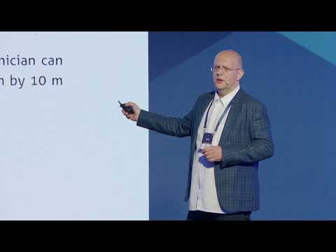

Arkadiusz Szadkowski of Esri explains why Esri speaks of reality mapping rather than reality capture: turning imagery, laser scans and meshes into a realistic 3D base map inside GIS, the foundation of every digital twin. Arkadiusz shows GeoAI models that extract features from orthophotos, point clouds and meshes, digital twin examples from Stuttgart, Oslo, Munich, Ljubljana and the Los Angeles fires, a dam project in ArcGIS Pro, a tech preview of Gaussian splats, and answers audience questions.
“So you can't manage what you can't measure, and you can't measure what you can't see.”
“For us, reality mapping is a realistic 3D base map for our GIS users.”
“Gaussian splats will fill in a sweet spot gap between the photogrammetry laser scanning”
According to Arkadiusz Szadkowski, reality mapping means turning captured imagery and scans into a realistic 3D base map for GIS users, so they can see what lies between their points, lines and polygons.
Yes. Arkadiusz Szadkowski said Gaussian splats are coming to Esri's reality mapping as one more export next to point clouds, meshes and orthophotos, developed at the Esri R&D Center in Stuttgart.
Arkadiusz Szadkowski explained that Esri's engine uses pixel redundancy, revisiting each pixel from multiple images to remove moving objects such as cars and to pick the best-lit image to reduce shadows.
Transcribed automatically (ElevenLabs Scribe) and lightly edited. It may contain small errors. Click a time to play the video from there.
Arkadiusz Szadkowski: Thank you. Can we start video, please? Okay. Yes. Hello, everybody.
Arkadiusz Szadkowski: Thank you for invitation and the opportunity to speak. My name is Arkadiusz. You can call me also Arek, and I work at Esri. I have a lot to cover today, so to... In order to find time for questions, I might rush a little bit through some of the slides, but I will stay here for today, so I'm happy to, to connect and network with you.
Arkadiusz Szadkowski: I will take you for the journey from reality capture through mapping modeling, from GI... With GIA, all the way to the digital twins. But to start, I would like to say the story. Probably centuries ago, a tribe leader gathered his people around him, took a stick and drew the settlement on the, on the ground. That's probably most likely how the Prague was born.
Arkadiusz Szadkowski: We humans, we are social creatures. We are driven by the purpose of belonging. We want to be informed. We want to know the plan. That's driving our business as well.
Arkadiusz Szadkowski: This is why we are capturing the reality, we are modeling and mapping it. And today it's all about the sensors. There is more cameras and sensors in this room than people, and those sensors gather information, location, images, transmit and broadcast all around to the servers, and you need to have a good system to manage that. And this, this is-- takes me to the definitions. So this is a reality capture conference, but we at Esri, we like to call it reality mapping, and in the next few slides, I will try to explain why.
Arkadiusz Szadkowski: So you can't manage what you can't measure, and you can't measure what you can't see. We are observing the Earth on a daily basis, from satellite level to the ground level. With various sensors. Uh, sorry, sorry, Lynn, I forgot about your mobile mapper. So let's go.
Arkadiusz Szadkowski: At reality capture and drone mapping, an aerial survey is... We, we at Esri started from the high altitude. So we started integrating imagery from the satellite and aerial and drone, and we are coming, and we will be releasing very soon the support for the terrestrial imagery as well. But what I want to say with this slide is that we see also that there is no clear line between the different sensors. We are observing the world at a different resolutions, of course, at a different capacity.
Arkadiusz Szadkowski: So we try to and we aim to be totally hardware agnostic and altitude agnostic. For us, reality mapping is a realistic 3D base map for our GIS users. They deserve to see what's in between the points, lines, and polygons and all the vectors that they are working on a daily basis. We define this as a way of reconstructing and creating a snapshots of the world for their GIS projects. And I'm here to say how and why it's worth to build the bridge between the reality capture and GIS.
Arkadiusz Szadkowski: And this takes me to this value proposition and the value chain. Most of you works from the planning or from... actually from the sensor planning and collecting the data. You are developing your services or value proposition for your hardware all the way towards the GIS users. We at Esri, we try to, with our technology, we try to stretch and reach from the GIS towards you.
Arkadiusz Szadkowski: But the reality is that we are not able to address all the markets by ourselves. We have a decent customer base, but there is existing entire market for the reality capture today. And this is a third party reality capture. And what we see is that a lot of our customers end up in a situation that when they want to bring your content or any other content, there is a time-consuming or very complex integration needed. They want to see this as one of the layers of their GIS systems.
Arkadiusz Szadkowski: So for us, the goal is this. We would like to integrate with anyone who's capturing the reality out there. We would like to create a true seamless end-to-end workflow for our customers, because this is the ideal partnership where customer, we... when we are together, removing all the obstacles between the capturing the data and bringing it to the system where he has all his other information. And of course, we are flexible around this, but we are developing the development tools and the whole, the tool set to, to allow that.
Arkadiusz Szadkowski: And I will show this in a moment. So I mentioned that we are altitude agnostic. We are today supporting the satellite imagery, aerial imagery, and drone imagery, any sensor, any hardware. We are releasing in mid-May support for laser scanning as well. And as I mentioned, we are going towards the terrestrial and indoor.
Arkadiusz Szadkowski: I will show a little bit of the indoor capability today, but we are, we are aiming to develop more. And to prove that we are really operating at any scale, this is the smallest drone ever created. It's a Black Hornet Nano drone. It's actually built two kilometers from the place where I live in Norway. It's a one K sensor used.
Arkadiusz Szadkowski: There's ten thousands of them right now in Ukraine, and the model and the products that you see has been generated in minutes after the data captured by the soldier in the field. We can go up. Of course, there are fixed-wing and sub-centimeter drone. We've seen beautiful examples from that today. If we go into the aerial resolutions, things start to be blurry and fuzzy, of course.
Arkadiusz Szadkowski: That's the, that's the price of the altitude and the loss on the fidelity and the resolution. So this brings me to the next chapter. Many of you might have been faced with these questions from your customers. It looks pretty, but what I can do with it? And this is actually a very good question.
Arkadiusz Szadkowski: This is where we can bring value, how to transform this realistic content into the information features or something that answers the questions to the GIS user. And for that, we need to start working backwards. We need to first accept and acknowledge that the GIS user thinks different. They-- There is probably the most talented crowd of the reality capture experts here today, knowing everything about the photogrammetry, laser scanning, Gaussian splats. I myself am photogrammetrist, but I know that a lot of GIS users, they don't really understand sometimes the difference between active and the passive sensors.
Arkadiusz Szadkowski: They want to have a streamed model in the correct location so they can see a content in the proper context. That's very important to understand this persona. So reality capture is all about collecting the data, as I mentioned before, and you are producing these beautiful outputs. But I, and with my team, we are on the mission to bring this technology to ten million ArcGIS Pro users and three hundred thousand organizations. And they think in three systems.
Arkadiusz Szadkowski: They think in the system of record, system of insight, and system of engagement. Where system of record is where they aggregate data, system of insight, where they look on the data, what you call viewers, and system of engagement, this is where they collaborate, where they take decisions, where they analyze. And there is another, of course, apart from this, my responsibilities also is to look where the market goes. And there, you have to be blind today to not see what is driving the market. The market is driven by digital twins, GeoAI, and I will talk a little bit more about it.
Arkadiusz Szadkowski: So digital twin has actually a definition. There is a digital consortium saying that it has to be an integrated, data-driven, virtual representation of the real world. But I like to say it has to be holistic, specific. It should have collected real-time data, and it, it has to serve the purpose to predict and provide you additional information. We at Esri like to say there is a digital twin journey.
Arkadiusz Szadkowski: There's a journey that you start with describing your reality. This is where you are modeling, where you're creating the model, the visual representation of your asset site. Then you upgrade it to informative level. You connect IoT sensors. You con-- You run some GeoAI on that.
Arkadiusz Szadkowski: You do some analytics. And then, only then, you can take it to the predictive or autonomous or comprehensive level. You are not able to create an autonomous digital twin before you are not, uh, before you describe it well, before you have a good visual representation of it. So for us, reality capture and mapping is the fundamental part. It's a, it's, it's a must.
Arkadiusz Szadkowski: This is where you start. You are creating your snapshot of the real world. You-- We want to connect it to the enterprise GIS system, connect it with the other data, because at the end, it's most important to build the right foundation so many things can grow from it, to enable not one, but many twins. So I will quickly jump for it. This is the, the way we are thinking.
Arkadiusz Szadkowski: And of course, we have a different model. So for us, reality mapping, it's all the way you are describing the reality today. So point clouds, 3D meshes, DSM and orthophotos, Gaussian splats will come as well. And then we have all the models of the enterprise GIS. So it's an individual tailored journey that every user has to go through.
Arkadiusz Szadkowski: You start with your margarita, with your base model. You add your topping, what you like, what is needed for your tool, and then you create your personalized digital twin journey. And of course, you can deploy in the way that you need to create an interface that is, is tailored for this persona GIS user. This takes me to the GeoAI. So we all experience the boom of the AI, and AI understands two things very well: language, all the chats, and image.
Arkadiusz Szadkowski: Image can be segmented and of course, uh, detected. So we apply that and created a lot of deep lea-- pre-trained deep learning models. So today when you work with us, you have two choices. You can use the pre-trained GeoAI model. There's ninety-two of them available for you.
Arkadiusz Szadkowski: And those I likely compare to the white car when you design the car, if you choose to buy the new car. So it's eighty percent done. The last twenty percent you have to tailor yourself. And then there is a deep learning studio where you can bring your existing mapping data. You can retrain our model or create your own model.
Arkadiusz Szadkowski: It's very powerful tool because if you have done a lot of manual work yesterday, you can use it to train your mo- model for tomorrow. And these models are trained to detect from images, from orthophoto, and also integrated, of course, all the text, some OpenAI vision, all the other open source models in this library. So because we really believe that the mapping will change, the time from the data to product will accelerate. This works in 3D as well, on point cloud or meshes. So detecting the cars, for example, with simple text prompt, "Show me cars," can be done in ArcGIS.
Arkadiusz Szadkowski: It can works also on the 3D mesh and put into the context, not only detect, but also query what is the visibility or what is the exposure of each of the window in the context of different GIS data. Yes, I should have shown this. So it's, it's a simple deep learning geoprocessing tool where you can create different, uh, with the text prompt, choose the model, and segment any objects. So mapping becomes more autonomous. Reality mapping outputs are the best input for your GeoAI projects.
Arkadiusz Szadkowski: The orthophoto DSM, 3D point clouds. Because the power of location this way is amplified by the power of automation. What you see here is an experience builder app with some of the reality mapping outputs for the city of Munich, where we run the different algorithms for the municipality. So reality capture in indoors, very quickly, we have an indoors functionality in ArcGIS that creates spaces. It's m- made mainly for the orientation, of course.
Arkadiusz Szadkowski: You can have a position like, like Michal showed in the twinzo. Uh, and last, well, not last month actually, we tested couple of different devices and scan our Esri, one of the building at Esri. And from point cloud to the floor plan, you can create it with the automatic processing at ArcGIS Pro. You don't have to digitize. Of course, there is some manual refinement needed.
Arkadiusz Szadkowski: I will show it later in the video. But there is a functionality from any hardware, any sensor, you can bring the point cloud and create, uh, 2D plans. And of course, you can also bring the three-sixty imagery as well to the indoors. We will develop more of that with the, with our reality mapping capabilities coming in the indoors as well. So a couple of the examples.
Arkadiusz Szadkowski: So I show, I show you that we actually walk the talk. So I like to say also that digital twins have a different phases. They can be looked on by use case, they can be looked by scale, they can be also looked by the cycle. And probably the project life cycle is the most familiar to you. So I picked, picked up a couple of the examples...
Arkadiusz Szadkowski: Sorry. From the project cycle. So the first one is design and construction twin. We are in the city of Stuttgart, where we have an aerial mesh combined with the, uh, complex B model of the new train station. So the city and the architects has combined the existing as-is situation awareness together with the as-plan new station and publish this.
Arkadiusz Szadkowski: And multiple organizations are working towards the same digital twin and are being informed on the daily basis what's the progress on the construction and how far we are from the plan. This was taken also to the game engine, so you can put it in the VR or, uh, augmented reality, so you are, are able actually to explore that in, in that kind of, uh, experience as well. Going further with the extend, uh, extended reality. We have an ArcGIS Urban X, we call it XR. Extended reality stands for a combination of the augmented reality and the virtual reality, where you can have a tabletop experience, and this, what I mentioned, this collaboration, a factor.
Arkadiusz Szadkowski: So multiple users can look on the same thing, talk to each other, and see through the glasses and explore the environment, discuss different urban planning scenarios, and decide about what is the best for the citizens. The urban planning twin for the city of Oslo, this is where they combine the mesh with all the other GIS zonal data. So, and publish it as a transparent web scene for all the citizens. Run simulations for the wind, pollution, noise calculations, and put the new development objects on top of that, just to ensure that all the citizens and decisions makers are well informed. Another example is the, we are back in the city of Munich, where the spatial statistics about the number of accidents has been overlaid on top of the reality mesh, just to show the new context to the content of the statistical information.
Arkadiusz Szadkowski: That gives completely different perspective of the information. We work also with the LiDAR data. So what we see here is the power line, twenty points per square meter helicopter data set. And with, with our tool, you are able to classify this automatically, segment, add the symbology, run the buffer analysis, and publish this as an application. So what we see here is the classification has been done with the automatic tools and the buffer analysis to the vegetation or the, or the, or the other buildings, and then the symbology added just for a easier streaming and, I would say the user experience needs to be much easier for the GIS users to look on the three-dimensional project data like this.
Arkadiusz Szadkowski: Instead of the point clouds, it's much easier for them to use the symbology. This is an inspection twin, where the mesh model, it could be also a point cloud in the 3D, is used for the situation awareness, and the oriented image is used for the inspection. Everything is connected to the GIS database, so the user is able to explore, zoom in to the case, and add annotations. Annotations are synced and published immediately to the enterprise GIS system. The same can be done with the full motion video.
Arkadiusz Szadkowski: So the drone can capture, of course, the laser and imagery, but also video. So sometimes the flight with the thermal infrared camera and RGB can be combined and overlaid on top of the 3D information. We see the footprint of the camera trajectory, and we are able to inspect the assets in near real-time. Here is an example with the combination of the mesh. You see the 3D mesh on the left-hand side with the re- re- near real-time trajectory of the drone.
Arkadiusz Szadkowski: We can pause the video and see on the thermal imagery an overheating solar panels and immediately annotate and report the, the issue with the installation. We have a connectivity with the game engines. We, we can synchronize this with Unity and Unreal. This is an example through the, the JavaScript SDK, where the mesh model and the s- city scale, the digital twin, has been published and used for the simulation of the rescue operations by the emergency units. It's possible also to run the flood simulations.
Arkadiusz Szadkowski: As you know, meshes are watertight, and with our tools, you can bring in the vector layer about the quality or the type of the soil. So of course, if it's a gr-- if it's a soil or the asphalt, it absorbs water differently. You are able to apply the infiltration parameter on different types of the mesh, basically slice the mesh into different pieces, and then run quite sim-- quite, quite realistic simulations of the water flow. This is a city of Ljubljana, where we simulated what would happen if in the mountains south from Ljubljana, where would be a rainfall similar to the one in Valencia last year. So they quickly discovered that they would also have a, a, a problem.
Arkadiusz Szadkowski: Another example is the power line, where we are doing actually the combining the laser scanning and the photogrammetry mesh. Photogrammetry mesh again is used as the base map. Laser scanning point cloud classified automatically for power lines, masts buffered on the zone, on the, based on the in- infor-- based on the distance from the power line, all in order to provide the situation awareness where the vegetation and clearance has to be managed. This is a public, this is a public scene I'm able to share with anyone who's interested. It has all the, all the reality mapping products online.
Arkadiusz Szadkowski: You all have seen earlier this year about the fires in Los Angeles, so reality capture and mapping has been a stakeholder. Apart from all the helicopters and airplanes fighting with the fire, there has been also multiple flights made to capture the imagery. The green trajectory you will see in a moment will be an airplane that is collecting the imagery. This imagery was quickly processed in-- with the reality products and provided to the emergency response at the Esri, and we created a digital twin for them, for the firefighters and all the other, um, uh, emergency response units. We integrated live information about the wind direction that is the most important in that kind of situations and provided this, uh, also to the citizens.
Arkadiusz Szadkowski: Our twins are able to also synchronize in the near real time between the applications like ServiceNow. So if you have a digital twin in the 3D and you have a metadata information connected to it about the maintenance costs or deadline, you're able to update it in your external database, and it's synchronized automatically with your 3D model. We also have a connectivity and we're bridging towards the AutoCAD. So there is called ArcGIS GeoBIM, which is basically allowing you to see the 3D GIS information on the one window and bring in the construction cloud information from the AutoCAD on another window. The same synchronization between the two views allows the user to have a single source of truth and update the both system of records, as we call it, at the same time.
Arkadiusz Szadkowski: So I want to go back a little bit to the reality mapping. So I want to demystify the reality mapping with ArcGIS Pro to show how easy it is. I'm right now in ArcGIS Pro. I imported four different flights, aerial flight and three drone flights. Of course, this is a dam, so quite complicated, uh, object to scan.
Arkadiusz Szadkowski: So we had to do some top to-- top view flight and also oblique view inspection flight. We quickly produced all the products, which is the d-digital surface model, true orthophoto, and also 3D mesh model. Everything, I'm still within the one application interface. And then right now I have a 3D mesh model. Together with this flight, there was an, of course, oblique imagery collected that was used for reconstruction, for the photogrammetric reconstruction, but also full motion video.
Arkadiusz Szadkowski: You will see it in a moment. So right now we are looking on the 3D mesh and oriented image use-- utilizing our oriented imagery viewer. Right now in May, we will have a huge upgrade to the oriented imagery. I know it was not the cutting edge comparing to other softwares, but right now there will be a possibility to overlay the information to the measurements and also overlay the GIS information on top of the, uh, uh, on top of the oriented imagery. Okay, we have to...
Arkadiusz Szadkowski: How is time? We have to accelerate. There is an application. I will jump. Let, let's wait for the full motion video so, so we can show this in a moment.
Arkadiusz Szadkowski: Yeah. And then here is the full motion video as well. You can publish this from the ArcGIS Pro to the Experience Builder app and make it, make it an inspection app as you've seen before. I mentioned indoor. So right now we imported the indoor point cloud into the ArcGIS Pro, and I have a longer video showing like within the five minutes the point cloud was converted into the 2D floor plan.
Arkadiusz Szadkowski: This 2D floor plan was automatically extracted with our geoprocessing algorithms. Of course, it's not perfect. You need to go and refine it. There is also some artifacts that you need to edit, but we have this editing capabilities that are semi-automated and user is able to snap and co-correct all the topology. These 3D indoors can be brought into the 3D reality and combined with the meshes.
Arkadiusz Szadkowski: So what I'm trying to say we are really go-- working inside out with our reality capture and reality mapping approach. Here we are. I have a short, uh, long video of the city of Prague. This is also public scene I'm able to share with everybody. We have a all point cloud mesh, also three-sixty imagery, GIS data, everything combined into the one application available online to explore.
Arkadiusz Szadkowski: So this becomes-- this all brings us to the point where we need to understand what is actually the value of the connected data environment. So I wa-- I'll ask you to think about the future, where you want to ha-- what is the important, and the data ontology will be extremely important, especially in the AI era, because you need to have your-- organize your 3D data in the way that they can be interconnected between the systems. You need to make the data accessible for your users, but also for AI agents. And then you need to also be able to visualize all the data together to create all context, to bring this meaning of the belonging for the people as they started the, the foundation of the Prague centuries ago. What I just show you was just seven percent of the applications and capabilities of ArcGIS Pro.
Arkadiusz Szadkowski: So of course, I'm focusing on my part of ARF responsibility, but ArcGIS platform is far more than that. We have one hundred and fifty apps available. If you are interested with what I shown you, take a picture now and go and Google and explore these applications, uh, because everything what I showed today was used with this, this, uh, handful number of applications. So our geospatial and location intelligence platforms enable seamless and end-to-end workflows from reality mapping through content data management all the way to the visualizations. Because we really believe that at the very end, the user deserves to s-- to migrate from the project thinking to platform thinking, from the product to the living spatial data set, from pixel and points all the way to the insights with as little obstacles as possible on the way.
Arkadiusz Szadkowski: I have six minutes. There is probably some questions, but there is probably a lot of people who are interested what about Gaussian splats. So yes. Of course, Esri has looked into the Gaussian splats, and Gaussian splats are coming to our reality mapping capabilities. They will be included in this fundamental part.
Arkadiusz Szadkowski: They will be just one, one of the exports from our all our reality mapping applications, together with all the other point clouds, meshes, and orthophotos. And I c-- I was allowed to show you a couple of the tech preview results. So on the left-hand side, you see our photogrammetry reconstruction. This is a drone imagery, I believe two centimeter. On the right-hand side, you see the Gaussian splats reality engine.
Arkadiusz Szadkowski: Oh, yes, of course, it comes with the price. You get a much better thin structures, but you get some smearing effect in the areas where there was a less, less overlap. What is... What I'm most impressed is the reflective surfaces, how it well handles the assu- If you ever work with the photogrammetry, you know that the reflective surfaces are probably the most, uh, most difficult to reconstruct. And, uh, what we see also, and we are very happy to look into the-- towards the infrastructure projects.
Arkadiusz Szadkowski: So Gaussian splats will fill in a sweet spot gap between the photogrammetry laser scanning, and p- maybe, maybe actually satisfy some of the laser scanning projects with the, with enough. Of course, if you have enough light to capture the imagery. So this is an example, another example of two centimeter of the scan. So that takes me to Q&A and takeaways. I managed to save five minutes.
Arkadiusz Szadkowski: There is couple of these, uh, story maps and scene viewers for you, so you can take a look closer on our technology. What I would like to summarize with is that for us, building the digital twins, it starts with reality capture. We like to call it reality mapping because we want to do more than just capture the reality. We want to extract features, build, map, model on it. We want to take it and connect it to the system of records of our customers, of our ten million GIS, ArcGIS Pro users.
Arkadiusz Szadkowski: They are sitting on a lot of data that... And this is a huge market that we really want to open for, for this, uh, this community. Thank you.
Host: Give it up for Arkadiusz. Arkadiusz, well done. Well done. Uh, we've got over twenty questions.
Arkadiusz Szadkowski: Oh my God.
Host: Come join me more at the center. So let's just bring up the questions over here on, uh, on screen so we can easier follow along.
Arkadiusz Szadkowski: Yeah.
Host: Perfect. So Martin Bellas is asking, "Which engine/program do you use and why?"
Arkadiusz Szadkowski: Okay, so Esri four years ago purchased a company called nFrames. Uh, this is today it's called Esri R&D Center Stuttgart. So this is their engine for their all the reconstruction. It's around thirty-five, forty people right now in Stuttgart working on our reality engine that produce all the reality outputs. Also, Gaussian splats is developed there.
Host: Cool. Uh, let's move on to the next one. Uh, can you share a real-world example where integrating reality capture into BIM significantly improved project outcomes?
Arkadiusz Szadkowski: Yeah. We need to this-- we need to agree on what are the outcomes. Of course, the-
Host: Mm-hmm
Arkadiusz Szadkowski: uh, so real world example. Uh, the Stuttgart, uh, maybe Stuttgart is not a good example, but, uh, Frankfurt, Frankfurt Airport, for example. There has been a-- Frankfurt Airport is one of our indoors and reality capture customer. They have-- They're utilizing the-- They utilized our technology to completely reorganize the airport. If you ever connected through the Frankfurt, I think it's quite good right now with respect of the connections and between the terminals.
Arkadiusz Szadkowski: So that's-- There is actually a story and blog post, so if you Google out Frankfurt Airport Esri, there is an entire article about it.
Host: Mm-hmm. Got it. Busy cities, dynamic environments, the next question just tackles that. How do you ensure the accuracy and consistency of captured data in these dynamic environments such as cities?
Arkadiusz Szadkowski: Consistency and captured data in the... Uh, okay. So, so of course, if... What I understand this question is removing noise, like moving objects and so on. So i-in our engine technology, uh, we have-- we've put a lot of focus on pixel redundancy, it's called.
Arkadiusz Szadkowski: It means that we really utilize and revisit every pixel from multiple captures. Because when you capture the same area from-- with five or six images, you will get sometimes the-- you will get an occluded view by tree, different building or a car. So our pixel redundancy algorithm, this is actually something that we are really good at, and, uh, I can, if someone who asked this question, I can refer to the documentation. We are able to remove all the moving objects like cars on the street. We are also able to remove and optimize the shadow.
Arkadiusz Szadkowski: When you fly with the drone or the aerial, you capture the same street or narrow streets from different angles, sometimes at a different time. So our software is looking into the m-mi-minimal, minimal occlu- shadow occluded areas and taking always the image that is the best exposed from the, uh, from the lighting.
Host: Mm-hmm.
Arkadiusz Szadkowski: Yeah.
Host: Thank you so much. Renata Simonian, can you please raise your hand? Who's that? Perfect. Thank you so much for all the questions.
Host: Give her a round of applause.
Arkadiusz Szadkowski: Okay.
Host: Look at that. The third question in a row, and you're asking really good questions because they are really upvoted. So thanks so much, Renata. Let's take a, let's take another one. We have, uh, one and a half minutes, so one or two more questions.
Host: So what are the biggest technical or lo-logistical hurdles in large scale reality capture projects, and how can they be overcome?
Arkadiusz Szadkowski: So the... I think the, the people who start doing the projects, they often, very often underestimate the scale and the importance of the computing. So there is still a thinking that with one license I can do a city digital twin or with one computer. So there is still, uh, I would say the u-huge underestimating, undervaluing the IT perspective of it. We are talking here about the terabytes or petabytes of data, huge computing power.
Arkadiusz Szadkowski: This has to be really scale. You need to have an infrastructure to that. A lot of organizations wants to adopt that, and then suddenly they realize that they need not only software, but they need to upgrade their hardware or go to cloud. But going to cloud also meets all the... Yeah, there is other challenges with going to cloud as well.
Arkadiusz Szadkowski: Yeah.
Host: Mm-hmm. Let's take the last one. We've got thirty seconds. Uh, we're gonna take one from Nina. Uh, can your technology also be used to detect dam-damage after natural disasters?
Arkadiusz Szadkowski: Yes. Yes. I actually removed the slide. We have an, we have an, a pre-trained AI model for detection of the destroyed buildings or any other objects. If you go to ArcGIS Living Atlas, uh, and, uh, select by deep learning projects, you will definitely see it.
Arkadiusz Szadkowski: So just visit ArcGIS Living Atlas. Yeah.
Host: Perfect.
Arkadiusz Szadkowski: Thank you.
Host: Arkadiusz, thank you so much.
Arkadiusz Szadkowski: Thank you. Thank you.
Host: Give it up for him one more time.

International Sales Manager at Esri
Arkadiusz is the Global Sales Manager for ArcGIS Reality at Esri, helping organizations worldwide turn imagery, LiDAR, and 3D data into operational awareness and real-world impact. He works at the intersection of technology and business value, bringing Reality Capture/Mapping, GeoAI, and Digital…