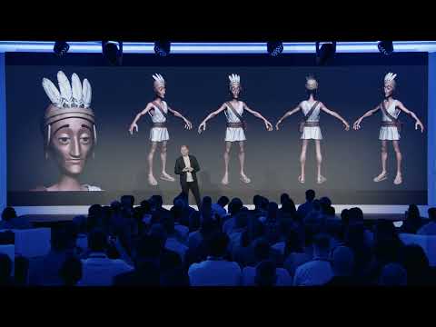

Bachaar Tarabay, head of scientific projects at ICONEM, shows how the company documents endangered heritage sites in around forty-five countries, from Mes Aynak and the Minaret of Jam in Afghanistan to Palmyra, AlUla and Hegra. Bachaar explains why ICONEM trains local partners and turns scans into storytelling with Unreal Engine, and presents the Vatican project – St. Peter's Basilica captured with photogrammetry, LiDAR and Gaussian splatting for an exhibition inside the basilica.
“Sometimes heritage is already gone, but this shouldn't stop us from recreating it.”
“it's very important to know why you are scanning the project, for who you are scanning it, and what are the objectives.”
“If the local actors don't take part in this, it means that our mission has, in a way, failed.”
According to Bachaar Tarabay, ICONEM combined about 450,000 photos with LiDAR and Gaussian splatting, scanned at night when the basilica was empty, and spent almost three months on the project, three weeks of them intensively on site with four or five people.
Bachaar said projects such as the Vatican and Notre-Dame are funded by Microsoft, while a large part of ICONEM's funding comes from public tenders by institutions such as UNESCO, ALIPH, the British Council and the European Commission.
According to Bachaar, careful planning around visitor flows and lighting is key, and ICONEM developed image processing techniques that unify colors and textures so LiDAR and photogrammetry can be mixed in the same software.
Transcribed automatically (ElevenLabs Scribe) and lightly edited. It may contain small errors. Click a time to play the video from there.
Bachaar Tarabay: Over there. Sorry for the-- Just looking for the clicker. It's okay. I'm gonna start. So, thank you everyone for being here.
Bachaar Tarabay: My name is Bachaar Tarabay. I'm the head of scientific projects at ICONEM. So ICONEM is a company that was funded-- founded three ti-- uh, thirteen years ago. Thank you. And it came from a need.
Bachaar Tarabay: So, so far, ICONEM has been able to work in more or less forty-five countries with the main aim is to digitize and document all the endangered heritage sites around the world. So we've been, we've been doing so around the world and trying to reach even the, uh, new, uh, limits, and it all started in Afghanistan. Our CEO, Yves, was working on an archaeological site, and he saw the dange-- the, how endangered the sites are and how, uh, fast they can disappear. So with the, the photogrammetry starting, like, in two thousand and ten, he was able to start scanning these sites, allowing specialists, arc-- uh, historians and archaeologists to study the site even from afar, giving them a photorealistic and high-precision model, identifying what are the needs of these researchers, and giving them access to tools that will allow them to better understand, to see different aspects of sites from a very photorealistic view and a multi-scale view in order to integrate the details within the site, within the natural, uh, natural environment that it is in. So as you can see, we can have a, we have very detailed look on all the cracks and all the textures and so on.
Bachaar Tarabay: So as you can see, that's a very old video just to showcase how we started working because, uh, we had to utilize our, uh, imagination and our tech in order to create these drones to be able to scan, uh, from afar these sites that are quite remote. This is the site of Mes Aynak in, uh, in Afghanistan. So now I'm gonna move to another site in Afghanistan. We had to take an helicopter to go there with the military just to see how stranded it is. So this minaret, Minaret of Jam, is quite a gem, an architectural gem for many reasons, and the objectives of these missions were va-- uh, varied.
Bachaar Tarabay: First of all, we wanted to document the site because it was really unreachable by anyone and, uh, not documented in high resolution till now. Second part, we realized that it was tilting, so it was very important for us to create a base model that we can utilize to be able to compare future digitizations of this site to better understand what's happening because of its natural environment within the, within a river between two mountains. So as you can see, we didn't stop at just making a scan of the site, uh, of the monument, but the site within because that's what gives you a all-in-all observation and understanding of what's happening. Sometimes heritage is already gone, but this shouldn't stop us from recreating it. So as photogrammetry, and as we know, photogrammetry in reality was a technology that always existed, even in the early twentieth century by archaeologists in order to be able to take measurements on pictures.
Bachaar Tarabay: So here, that's a Temple of Bel. The Temple of Bel was destroyed because of conflict in Syria. This is the site of Palmyra. So it was important for us to work with archaeologists, historians, and local architects in, and archival imagery in order to recreate the site. This gives the people a better understanding of the scale of the site, of the components, whether because it's not always, uh, it's not always fun to just look around rocks for people who aren't, uh, very in archaeology or history.
Bachaar Tarabay: More n- more than that, we wanted to share this knowledge. It was very important for us to create a capacity-building project with local actors. All the mission that you have seen and all the countries that were highlighted in the maps, we c- we have local actors that we train, that we equip, because for us it is very important because they enrich us with their knowledge, and we try to give them what we know of this technology. So we created like a sort of white book guiding them, a training that would go for a week, train, uh, in order for them to get the main techniques to be able to recreate these three D models. And with each mission, we created like a family.
Bachaar Tarabay: We have families all around, for example, for now in forty-five countries, and whe- when there's any, uh, problem, any conflict, any destruction, they come to us, sending us data, telling us what sh- we should do with the techniques you told us and vice versa. Sometimes we need information on sites that are very, uh, very far away with limited documentation given, uh, their, uh, geographic localization, well, we have people there that can go scan them, study them, and, uh, give us a feedback. And it warms our heart when we see on Instagram stories, for example, one of the people we train doing photogrammetry by themselves because on, in reality, it seems like a magic technology, but it's, it's, uh, fr- in the, within the reach of a palm of anyone who just want to learn it. And at the end, it was very important for us to, uh, to be able to deliver this because we're, we, uh, we, uh... How to say it?
Bachaar Tarabay: I forgot the word. We realized, we realized that a lot of these people don't know the richness of their heritage. So by showcasing this 3D model and the creation of immersive experience like the one I'm gonna show right now, it allowed us to recreate a s- a storyline, a storyboard, in order to better say, better tell the story. And without the local actors, we wouldn't have all this information, and this video would have lacked so many, so many content and layers in order to give you the right, uh, information. So this is a project that has been done in AlUla with AFALULA and the Royal Commission of AlUla.
Bachaar Tarabay: The aim was to scan the site in the best resolution possible for archaeologists, but not to stop there. We created with Unreal Engine, uh, many animations showcasing the site, how it got created by doing 3D modeling, combining them with arch, uh, photogrammetry, laser scanning and so on, in order to create this narrative to better show people the greatness of the creation of these monuments, all the challenges, challenges that they might have faced for creating them, and not stopping there. There's another video that I'm gonna be showing just after where we recreated the old city of Hegra. So this is very important to see that it's a multidisciplinary, uh, uh, domain, where every input from anyone in cultural heritage section, whether in tech or just in history, can give us a huge, uh, input in order to make this, uh, this work even more meaningful. And this video is about the village.
Bachaar Tarabay: So as you can see, all every-- all the surrounding is, uh, scenery that had been, uh, scanned with, uh, drones and, uh, cameras, and all the rest has been, uh, modelized and, uh, 3D constructed by our local ac- uh, local, uh, team by exchanging with local actors in order to better understand the archeology, the history, the composition, the materials that have been used, the objects, and even the textiles as Tomáš, uh, was showing in the, his first, uh, Machu Picchu presentation, because it's important for us to be able to give the most accurate information, to give, for example, here the lighting, the reflection of the materials, what people were wearing because it gives you a very big story and a better understanding of everything that's happening, that was happening in this site. And, uh, to showcase these people, uh, living in this site, roaming around, gives you a better and more vital, uh, image of how it was once upon a time. So I'm just gonna pause a bit just to showcase the video, and then I'm gonna show you the big project. So there's alway- also vocal testimonies that have been, that had been used in order to tell the stories because the narrative is very important. It's very, uh, one-- it's one thing to scan a site, but it's another to create, to im- to adapt the input to the narrative, to the storyline.
Bachaar Tarabay: What do we want to show the people? What is the story that you want to convey? And now, the big, uh, the last biggest project that ICONEM did was the scan of the Vatican. It was a very complex project, and as we like to do, we like to push our limits. So as to, to give you an idea, this is the biggest site that we were able to, uh, to scan within as, uh, data, not as in a sur- surface.
Bachaar Tarabay: So we had to use four hundred fifty thousand pictures in order to recreate. Everything you're seeing here is a 3D. So we were able to scan all the basilica from inside out, allowing us to document the site, to work with the local, uh, the, the church, the basilica, and, uh, to document, to give them accurate information and documentation on, uh, the aspect and the state of the basilica, but not only. It was very important for us to let the public engage with this exhibition. And we thought that if, if we would create this exhibition elsewhere, it would lose a bit of its importance.
Bachaar Tarabay: So that's why we create, we decided to create an exhibition within the Vatican. It's like Inception. You're seeing a 3D within the monument, allowing you to see spaces that aren't really easy to see with the naked eye, allowing us to use different techniques. There was a lot of challenge with reflection on the marble statues and the flooring. So we used Gaussian splatting, we used, uh, photogrammetry, we used LiDAR scanning in order to really grasp the intent, the complex, the complexity.
Bachaar Tarabay: And on top of that, we recreated this 3D model of the city to really better understand how the basilica got here. We were a- also-- we were obliged to use a drone inside the basilica, and we did the scans at night in order for the basilica to be empty. So here are, uh, visualization of, uh, parts of the exhibition that we created within the basilica, allowing you, for example, to see elements that are, uh, very far away. These are the splats we were able, we were trying... This is from a splat that we created this, uh, model in order to see, to test what we can do.
Bachaar Tarabay: And we also integrated AI in order to, uh, depict ev- any losses that we can find in mosaics or any cracks that might appear. And these kind of elements are very hard to depict because they're in the upper cupola of the basilica that is, like, more than fifty, sixty meters, uh, above our head. So it's just to see that, just to say that it's very important to know why you are scanning the project, for who you are scanning it, and what are the objectives. Because it will give your project way more sense, and it will allow you to implement what you did with the wider public and the local actors, showing them what is the importance of this scanning and engaging with them. Because at the end, these are the people that are the guardian of heritage.
Bachaar Tarabay: We can go around all the world and scan whatever we want. If the local actors don't take part in this, it means that our mission has, in a way, failed. So it's just a way for us to show them the importance of their heritage and, uh, the importance of scanning it and safeguarding it for their future civilization using the latest 3D technologies and pushing forward. And hopefully next year we'll be able to showcase Notre Dame, because we're actually doing with Microsoft another project that is gonna resemble what we've done at the Vatican by creating an exhibition within the Notre Dame that would, I would invite you to visit in a year or, or in a year and a half. Thank you.
Host: Incredible presentation and project.
Bachaar Tarabay: Thank you.
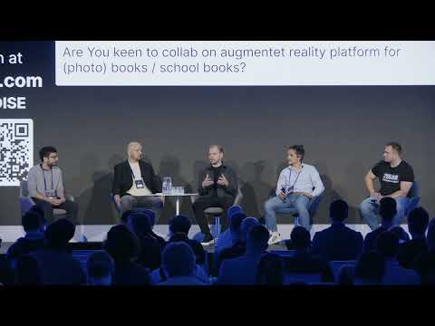
Host: Uh, once again, lots of questions coming in from the audience, and we've got plenty of time, so let's just tackle them one by one. Um, are your models used anywhere outside of archeology?
Bachaar Tarabay: Of course, we use our models on, for different aspects. So we use them in order to create art installations. We use them also to create, uh, how to say it, 3D printing objects. So it really depends on the... Or even when we talk about archeology, archeology is very specific because you only al- also use it for restoration that is a bit different from archeology.
Bachaar Tarabay: By creating a document, we use it also for education tools, by creating s- models that we use to upload on Sketchfab, by implementing points of interest that we now do on our own platform if you would like to visit, app.iconem.com. And it allows us to really see what are the needs of the heritage, but not just archeology.
Host: Mm-hmm.
Bachaar Tarabay: Thank God.
Host: Uh, you've got a beautiful shout-out. I really like it. Best wishes. So somebody... Who was that?
Host: Is that, I can see the, the hand up. Was that? Okay. Then that's an AV team at the back. Aha, the gentleman over there.
Host: So you get a, a shout-out from him and from other people. Um, all right. Who is financing these scanning projects?
Bachaar Tarabay: Um, many kinds of funding. So for example, private, uh, com, uh, projects like, uh, the Vatican or Notre Dame are funded by Microsoft, so a private company. But a big part of our fundings come from international institution like UNESCO, ALIPH or other, uh, British Council, for example, depending on this, the project. Because in fact, one of the aim of our digitization main aim is to be able to scan for documentation and herisage, heritage preservations. Everything that comes after, for us, is, uh, a plus that we love to do because that's the small extra mile that allows your, uh, work to reach everyone.
Host: Mm-hmm. How do you combine all the information from inside and outside, LiDAR, photogrammetry and all the other sources when capturing on different dates?
Bachaar Tarabay: Uh, many layers to this, to this question.
Host: Right.
Bachaar Tarabay: So generally when we do the, when we plan, this project took a lot of planning. Uh, f- first of all, it's a very big touristic site, so we had to manage the flow of people. Second of all, the lighting, the change of scenery and so on. So as we know, when stuff move in photos, in photogrammetry, that's not, not a problem. But when there's a big change, we need to acquire it to rescan the site in this aspect.
Bachaar Tarabay: But generally, we created techniques and image processing that would allow us to unify the colors and the textures on a site, allowing us to mix LiDAR, photogrammetry and scan within the same, uh, the same software.
Host: Mm-hmm. Got it.
Bachaar Tarabay: Shout out to RealityScan.
Host: Uh, okay. Talking more about that project, how many people scanned Vatican and for how many days?
Bachaar Tarabay: So if you wanna put it in, uh, it, it, it, uh, it's, uh, how to say, we spent almost three months with three weeks intensive on site with more or less four or five people working, uh, there.
Host: Massive. Um, have you worked on any films or games where you use these techniques?
Bachaar Tarabay: Not yet. We've been exchanging with different companies and for example, we did the scan of Venice a couple of years ago, and within the exhibition there was a part for Ubisoft where they showcased the Assassin's Creed Venice edition.
Host: Mm-hmm.
Bachaar Tarabay: And we can see the difference, but as you, as many said before, the pipelines to use this, uh, the pipelines are very different and we're trying to align with them in order to make it happen.
Host: Mm-hmm. Perfect. Uh, question, how did you come up with this idea?
Bachaar Tarabay: Which idea?
Host: Uh, good question. Uh, a lot of ideas have been shared. Who posted that question? Anybody who wants to elaborate on that? No, no, no.
Host: All right. So maybe with the idea of, uh, scanning the Vatican, how did that project come about?
Bachaar Tarabay: It was a back and forth. So after we did Venice, there was a lot, uh, we created like a network with Italy.
Host: Mm-hmm.
Bachaar Tarabay: And we were at the same time creating a network with Microsoft. We identified, so either the Vatican identifies them, but in this case, we identified this project with Microsoft and collaborated with them. So it was a multi, uh, I would say, a multi-source project with different actors, main actors, not just ICONEM deciding to do the project.
Host: Mm-hmm.
Bachaar Tarabay: So we had to take into consideration many actors. Without them, we couldn't have been able to do it.
Host: Mm-hmm. So questions are coming in about the Vatican. How long did the post-processing actually take?
Bachaar Tarabay: The?
Host: Post-processing. How long did it take to process the data from Vatican?
Bachaar Tarabay: A lot of time. Even had to, uh, to buy a new computer that would, uh- Be able to process this amou-amount of data. We arrived to one teraram.
Host: Mm-hmm. Somebody would love to see, uh, a new Assassin Creed in Vatican. Uh, can you shed some light on that?
Bachaar Tarabay: We never know. We never know. The, uh, in all cases, if you wanna visit, there is the-- we created, um, a platform where you can, uh, visit the tiled model, a mesh model of all the Vatican that is more or less a guided tour where you can see the different aspects and the information you might want to know, uh-
Host: Mm-hmm
Bachaar Tarabay: on different parts of the monument.
Host: Mm-hmm. So somebody's asking about the specifics. How do you reconstruct glass and windows in your scans and models?
Bachaar Tarabay: So there's a lo-- we have a 3D team that is working day and night on this project, so scanning is one thing, but making the scan come to life and, uh, integrating all these aspects like the glass, the reflection, is work that ha- that is being done afterwards in order to ensure the best quality of the model.
Host: Very cool. Uh, yeah, somebody's asking about, uh, Jeffrey's actually asking about, um, how you got these jobs. Uh, was it via public tenders or, or something else?
Bachaar Tarabay: Definitely public tenders are once, one of our main, uh, source of projects.
Host: Mm-hmm.
Bachaar Tarabay: The last one we did, uh, the last time we did, we were able to scan a lot of sites in Lebanon, for example, that were endangered and other places in Libya and so on. So a lot of, uh, like the European Commission, like the British Council, like ALIPH, UNESCO, they all, uh, publish public, uh, public proposals that we apply to.
Host: Mm-hmm. Uh, let's touch on this last one about scanning the ceiling. How did you do that, with drones?
Bachaar Tarabay: No. For the Vatican, it wasn't done by drone because the drone we used were the Mavic 3, and with the Mavic 3, you couldn't tilt, uh, the gimbal in order to capture just the... So we used a couple of different focus with the cameras, and we only use cameras. We try to get as high as possible within the structure of the Vatican and take as many images with different zooms, optical zooms going from twelve to seventy millimeters in order to make sure that we have the best data and the, the highest quality, and we mix them with the big, uh, big model. So there wasn't, uh, how to say, a magic, uh, tool.
Bachaar Tarabay: But the drone is an option that we could, uh, rely on in the future, especially with Mavic 4, that can help us, uh, really rotate the gimbal in all the directions.
Host: Bachaar, thank you so much for, uh, your presentation and taking the time to answer all these questions. Let's give it up for him. Thank you. Thank you so much.
Bachaar Tarabay: Thank you.

Architect specialized in heritage (ENSA-PB), Head of Scientific Projects at ICONEM
He leads documentation and risk assessment missions in conflict- and climate-affected regions, combining fieldwork, scientific research, and international coordination.