

Piotr Strzelecki of Trimble describes how scan data and 3D models still get shared through screenshots, emails, USB drives and PDFs, and why that leads to rework. The talk walks through Trimble's field-to-office-to-field loop: field scanners and SiteVision upload directly to the Trimble Connect common data environment and its reality capture add-on, design happens in connected tools, and models go back to the site for layout and augmented reality.
“large-scale data very often is collected, used once, and then left somewhere or deleted and never touched again.”
“Well, to be honest, human is always the biggest error on a construction site.”
“It's not just a file-sharing platform. This is a collaboration platform where you can delegate tasks”
Piotr Strzelecki described Trimble Connect as a common data environment and collaboration platform that connects the right people to the right data, with task delegation, teams and BCF topics, not just file sharing.
According to Piotr, the field software such as Trimble Access needs Trimble hardware, but Trimble Connect, the reality capture platform service and the modeling software do not require it.
Piotr said Trimble runs a university program; it is arranged per university, not per person, through the local dealer.
Transcribed automatically (ElevenLabs Scribe) and lightly edited. It may contain small errors. Click a time to play the video from there.
Piotr Strzelecki: That would help. So, uh, this is my first time on this presentation. It's just a pleasure to have such a beautiful crowd in front of me. I just learned yesterday, to be honest, how to properly pronounce. It's actually 3DISE.
Piotr Strzelecki: Is it correct? All right, so jumping to my presentation, the title seems to be pretty long. So what I am going to cover is how Trimble envisions the connection in between the, uh, physical world and the digital world. How we connect the data from the field to the office, how we connect the office to the field back, and how we use the re-reality capture data, point clouds, and how we use the 3D models here as well. But let me start with a story, a story of our customers.
Piotr Strzelecki: Something what we hear for years on how people exchange the data, how they col-collaborate. So we've got this terabytes of point clouds coming from mobile mapping scanners, terrestrial scanners, LIDARs, and so on and so on. Then we've got the gigabytes of 3D models. And then what happens next with the point cloud to share and actually collaborate, very often we just create a snapshot, send it by email, and ask, "Hey, can you please make sure that these walls are, uh, placed correctly?" And then if I am a manager, if I am a site manager, am I really sure that the person has really accepted the job?
Piotr Strzelecki: Is the job delivered properly? Or we just use commonly available tools online to share files, right? Is it really a work delegation? Am I sure that I have sent proper data to the proper person in this way? Or imagine a situation that on one side of a country, you're collecting your fragile data of your customer with the point clouds and then send the USB drive across the country to the office.
Piotr Strzelecki: Is it really secure? Where is the security? Are we sure that we do not really do anything wrong with our end customer's fragile data? I'm not so sure. So on the other hand, we've got beautiful 3D models designed in, uh, in office software, having all this database behind attributes and families and so on and so on.
Piotr Strzelecki: And what we see in the end is that we factually do this, right? We still create PDFs, we still create, uh, blueprints and collaborate based on them. Is this really a digital construction? I'm not so sure. So in the end, we end up in a situation like this.
Piotr Strzelecki: Or we end up in a situation like this. And by the way, there was no AI used here. Real-time examples. This is something what we have seen on construction sites. So if we just-- We have this from our customers, and we also see this in studies, that actually large-scale data very often is collected, used once, and then left somewhere or deleted and never touched again.
Piotr Strzelecki: It's like ninety-six percent of the data is actually never used again. Then all this misinformation, miscommunication that we have on the construction sites, all this... Well, to be honest, human is always the biggest error on a construction site. Unfortunately, we are the ones who introduce the errors, and it's estimated that because of the miscommunication, we have around two hundred and eighty billions, uh, dollars spent annually on re-rework and delays due to a poor communication. So if we have a rework, if we have the delays, it also influence the environment, which you can't forget about, right?
Piotr Strzelecki: So we estimate that around three percent of, uh, global carbon emission comes from rework and delays of the projects. So we thought about it. We thought about this idea, about these issues, how to solve the problem, what we could deliver to our customers, how we can help. And we've come up with a solution, which is Trimble Connect. This is a common data environment, a collaboration platform that connects the right people to the right data at the right time with right processes.
Piotr Strzelecki: It's not just a file-sharing platform. This is a collaboration platform where you can delegate tasks, you can create, uh, teams, assign work based on the most human thing that we can s- uh, actually use. It's a 3D- And, uh, visualization. Well, you've already know this number that we had this question yesterday. So we have daily active users of Trimble Connect.
Piotr Strzelecki: It's more than thirty million people actually. So it's not just a platform that is sitting dead, it's really implemented on a construction site. Companies use it, and they really like the solution. Well, so that's our teaser video for Trimble Reality Capture Platform Service, which we actually all call TRIPS. Which is not allowed by the way, you can't call it like this.
Piotr Strzelecki: Which is an add-on to the, uh, Trimble Cor-Connect that actually uses the reality capture in the cloud. So let me now walk you through the, uh, whole workflow, how we really envision connecting the, uh, physical to digital world. So on the one hand-hand side, we've got the, uh, field, uh, site where we measure, capture, monitor, layout, and all... Do all the things with the data. And on the other hand side, we've got the analytics, reporting, design, planning, and management, which is, let's say, the office and design part of the, uh, solution.
Piotr Strzelecki: And Trimble Connect is the, uh, platform that connects both worlds. So the portfolio, how it works with our product. First of all, we have this backbone sitting in a cloud, Trimble Connect and Trimble Reality Capture Platform Service that connects the field office and office to field back. Then we will have the, uh, we will have the field component where you can actually use the, uh, scanning total station, uh, terrestrial scanner, SiteVision with lidar-based phones, mobile mappers or rail trolleys for scanning together with their field software. And imagine this, all this field software, they collect reality data, and they send this reality data from the office, from the field directly to the cloud.
Piotr Strzelecki: There is no cables, no emails, no other services. Field software just sends everything directly to the cloud. If needed, data can be processed in our office software, things like Trimble Business Center, RealWorks, or, uh, Gida Scan Office. And this software go to Trimble Connect, take the data from, from the cloud and use it there. Well, once we have the surveying deliverables, we can actually do some design.
Piotr Strzelecki: And within Trimble ecosystem, in our portfolio, we have plenty of software that can be used actually for the design. Things like SketchUp, ProjectSight, Tekla Structures, Quadri. But we imagine that Trimble Connect should be used as an open platform. We don't wanna close the environment. We wanna have it as something that you can actually implement into your solutions.
Piotr Strzelecki: If you would be interested to write a plugin or use the API to connect Trimble Connect, let's have this conversation. We have a booth over there, so we can, uh, discuss the opportunities. So if we now look a little bit more in details, uh, imagine the situation that we start in a field. We have the X9 scanner that actually collects reality capture data itself. It is a self-calibration scanner in a field, meaning that you will not have to send it for factory calibration.
Piotr Strzelecki: You will not have to spend money on factory calibrations. You will not have to wait a couple of weeks until it comes back from the shop. And then it collects the fully registered, fully colorized geo-referenced point cloud in an agnostic format together with your annotations, points, measurements, and sends everything from the field directly to Trimble Connect. Or, uh, if you would need-- thank you, Yuri. If you would need something, uh, smaller scale, uh, solutions, you may actually use, uh, Trimble SiteVision, that when it's coming with the lidar phone, lidar-based phone, you can use the phone together with the GNSS, uh, system here to scan, for example, the utilities, create the BCF topics, create the ideas, and then send it directly to the cloud as well.
Piotr Strzelecki: So once the data is collected, it's in the cloud. Now it's time for collaboration. In Trimble Connect, you can create teams, you can manage users, you can manage delegations, you can manage estimations, you can share your views, you can create BCF topics, you can delegate work tasks, and as a manager, you can also control who is getting what and where. Once we share the data, uh, we can actually do some design. So you can use, for example, SketchUp or Tekla structures for some steel operations or prefabrication, or you can use Quadri for your roads, for your corridors, for rail.
Piotr Strzelecki: And, well, we are open, so just go ahead and use your own software. Some of the most known stakeholders in the in-industry, they already have plugins and connections to Trimble Connect that you can just push, pull data back and forth, for example, from, uh, Revit or Autodesk. So we've got 3D model. Now it's time to come back from the office, uh, to the, uh, uh, to the field. So just take your total station, do your set outs, do your layout, do your-- do the stakeout, or use the SiteVision with a tablet.
Piotr Strzelecki: Uh, upload your, um, model from Trimble Connect and visualize actually everything in augmented reality. And a very important thing is that when you have any change with your model, which happens sometimes, that there are updates, there are new versions in a cloud in Trimble Connect, our field software will automatically detect it and tell you, "Hey, there is a change in the model. You should really take the new one and use the new model for your set outs." In this way, we integrate the physical with the digital world, and in this way, we actually eliminate the human error which is coming from the data sharing and work delegation. Uh, let me just briefly, uh, show you a project that I actually have with me on my booth over there.
Piotr Strzelecki: So if you wanna see the details, please, uh, come, have a look. Let's discuss on the data that we have here. So it's-- that's the project from the UK where we have some orthophoto maps, GIS data, imported rail, roads, bridges, DTMs, many other things. If you just zoom a little bit to the area, I wanted to show you just last slide, uh, which is a cut through a 3D model together with a point cloud, some annotations, measurements done, and actually the, uh, BCF topic created. So work delegation based on your view and delivered to, uh, Gregor, which is actually critical.
Piotr Strzelecki: So Gregor now needs to go and do his work.
Host: Need to.
Piotr Strzelecki: All right. So thank you very much for the invitation. Thank you very much for your attention and time. If you wanna connect on LinkedIn, that's me. I'm just a bit younger over here, but that doesn't...
Piotr Strzelecki: Right. I think it's-- we have some time for questions.
Host: Absolutely. Let's give it up for Piotr. Piotr, thank you so much.
Piotr Strzelecki: Thank you.
Host: And we do indeed have questions. Let's put them up on screen, please. Um, and we'll start with the question about the competitions. So how do companies like Trimble see competitors like XGRIDS enter the market with really powerful tools, uh, and low prices whilst sh-charging three thousand-- uh, sorry, thirty thousand plus on a GNSS device?
Piotr Strzelecki: Well, we observe the market situation. That's, I think, the best answer, uh, to this one.
Host: Okay. Uh, let's move on to the next one. Do you need-- Uh, sorry, they're jumping, uh, up and down. Uh, what is the price for your software?
Piotr Strzelecki: Uh, that would have to be a little bit more detailed.
Host: Mm-hmm.
Piotr Strzelecki: I suppose it depends on the configuration and software that you would like to use and the workflow that you would actually like to use. So, well, you're more than welcome to join our booth. We can discuss this with the dealers. Uh, we have our Czech dealer, Slovakian dealer, and actually Polish dealer here on the exhibition, so we can just have this conversation there.
Host: Mm-hmm. Do you need to have Trimble hardware to use the Trimble software? Is it possible to add data from different hardware suppliers in your software?
Piotr Strzelecki: So when it comes to field solutions, yes, you will have to have, um, uh, Trimble Access, for example, to work with, uh, field element of the, uh, software. But when it comes to Connect or, uh, Trimble Reality Capture platform service or any other echo-based pieces of software or creating 3D models, then it's not really requested.
Host: Mm-hmm. Uh, next one. Are the products only for companies or also for personal use? And can I find it on the European market?
Piotr Strzelecki: Uh, yes, we've got a lot of customers, uh, using Trimble Connect and reality capturing, uh, in Europe. It can be used for personal use as well, but to be honest, the target is, is the organizations.
Host: Mm-hmm. Let's move on to the next one. Uh, Simon, uh, it's more of a comment over here. You have to be careful with clouds on models because then you have a cloud cut out in the structure for ventilation.
Piotr Strzelecki: You have a cloud cut.
Host: Simon, do you want to elaborate on that?
Piotr Strzelecki: Yeah, go ahead, Simon.
Audience: The 3D model, you show the clouds, and after that, on the real photos, you have the cut out clouds for the ventilation.
Piotr Strzelecki: Ah, yeah.
Host: Okay.
Piotr Strzelecki: Of course. We, we also take care of the trees because sometimes they are blue-
Audience: Yeah
Piotr Strzelecki: when you're outside.
Host: All right. Moving on to the next one. Can you use the captured data outside of the software to edit, uh, save local or share?
Piotr Strzelecki: Yes.
Host: Okay, perfect. And, uh, let's take a look at this one. Do you have any discounts for students?
Piotr Strzelecki: Uh, yeah, Trimble, Trimble has a university, uh, program that we can provide special, um, solutions for the universities. It's not, uh, per person, uh, let's just say it this way. We should be contacted, uh, through the dealer. I mean, your professors, your managers in the university can contact, uh, our local sales channel, for example, Geotronics Prague, and then we can, uh, have this, have this cor- uh, organized.
Host: Piotr, thank you so much. Ladies and gentlemen-
Piotr Strzelecki: Thank you
Host: Piotr Strzelecki.
Piotr Strzelecki: Thanks a lot. Thank you.
Host: Can you pass to the next speaker? These guys.
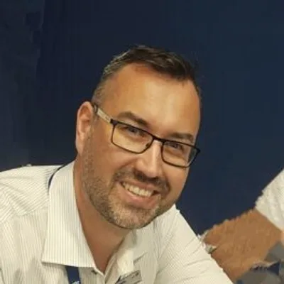

Sales Engineer, Trimble Geospatial
Piotr Strzelecki is a Sales Engineer with 15 years of experience driving Trimble’s sales and presales initiatives across the EMEA region. His career has focused on moving the industry beyond fragmented data sets toward fully integrated field-to-office ecosystems. In his current role, Piotr helps…


