

Rami Tamimi, a professional surveyor and PhD candidate at the Ohio State University, walks through building a custom mobile mapping system on a Tesla (lidar, GNSS, IMU and cameras) and what it took to prove its accuracy. Rami shows why pure SLAM data drifts without georeferencing, why a handheld scanner was not good enough as ground truth, and how a terrestrial laser scanner with 70 surveyed control points finally provided it, before turning to the real research goal: georeferenced imagery from the Tesla's own dash cams.
“So you need the sensors. You need to georeference your data. You need to know where it's at.”
“sometimes you have to do the hard labor, the in the field, the boots on the ground work in order to get proper ground truth data.”
“So if you're not establishing survey control, if you're not using different sensors to collect data, how do you know your data is actually valid?”
According to Rami, frame-to-frame ICP produces a clean-looking point cloud that floats in space, bends and is not georeferenced; you need GNSS and IMU sensors to georeference the data.
Compared with TLS ground truth, Rami measured about 8 cm relative accuracy, and absolute accuracy of about 9 cm in open sky, 11 cm under trees and 18.5 cm in the hardest GNSS corridor.
Rami said you never need it: one rover with the IMU plus a base station is enough, and extra receivers only help calculate the lever arm more accurately.
Transcribed automatically (ElevenLabs Scribe) and lightly edited. It may contain small errors. Click a time to play the video from there.
Rami Tamimi: Thank you, my friend. Thank you. Appreciate you. Good afternoon, everybody. How are you?
Audience: Great.
Rami Tamimi: That was a good lunch, right? Kinda getting ready to sleep, right? So I'm gonna try to keep the energy flowing. I'm gonna try to, uh, encourage you and walk you through the struggles that I faced as a PhD student, uh, as I build my own custom mobile mapping system. This is a part of my research and what I have been doing over the last several years.
Rami Tamimi: And I hope you find some enjoyment and some pleasure in understanding how all of these systems work. Fair warning, these are gonna be the most unsexy point clouds that you have seen this entire conference. Uh, but I hope that you can enjoy the level of accuracy that we've embedded into them. So, let's start with this, okay. So Elon Musk is not a big fan of LiDAR, right?
Rami Tamimi: He doesn't put it in his vehicles. He doesn't think it's a proper sensor that can actually help with self-driving vehicles. You know, he, he kind of makes fun of Waymo. He makes fun of any company that tries to incorporate these sensors. And I'm sitting in a room full of people that use LiDAR every day, so, um, naturally, I put a LiDAR sensor on my Tesla.
Rami Tamimi: This is just the beginning of what would become several months to several years of research, trying to figure out if Elon is right or not. Um, this is what people make PhDs on, it's trying to challenge billionaire CEOs. So for those of you who don't know who I am, my name is Rami Tamimi. I am a professional surveyor in the United States. I'm also a PhD candidate at the Ohio State University, studying geodetic engineering.
Rami Tamimi: Uh, I think many of you probably know me from the internet, where we have over eighty-eight thousand subscribers and over seven million views on my YouTube channel. Uh, and I am also the founder of The Survey School, uh, a place where you can go to learn about surveying. We'll talk more about that at the end. Uh, but I'm just really excited to show you what I've been working on, honestly. So the first approach that I wanted to take with this is understanding what sensors I needed to add to my Tesla.
Rami Tamimi: And I was like, "Okay, I have a GNSS receiver," right? This is an Emlid Reach RS3. I'm just gonna attach this to the top of my vehicle, and theoretically, I should be able to just drive normally and capture positional data. So I just ran an auto capture every second, and as I drove my car around, this is, uh, a library in my area, uh, I was able to capture, you know, fairly accurate GNSS positioning. And using the heading of the GNSS, I can figure out my kappa value and estimate the trajectory of the vehicle.
Rami Tamimi: So pretty basic test went well. Not letting me. Come on. Oh, I guess we have to finish the loop. All right.
Rami Tamimi: Finish the loop. Can we go to the next slide, please? Thank you. So then, uh, this became a much bigger project, right? This is my advisor, Dr.
Rami Tamimi: Charles Toth at Ohio State. Uh, we put together this giant rig, this custom mobile mapping platform. And using this platform now, I will be driving around campus, collecting as much data as I can using my Tesla. So what's the sensor stack, right? At the front and at the back, we have two Velodyne VLP-16 LiDAR sensors, right?
Rami Tamimi: Very standard VLP, uh, easily able to extract frames of, uh, each, you know, s- me- uh, what is it? LiDAR frames, I guess, as you're mapping, um, and be able to integrate them into your workflow. And then I put a, uh, NovAtel SPAN IMU sensor so that we can get our, uh, omega-phi value, omega-phi-kappa values. And then on top of that, we had two GNSS receivers, one Emlid Reach RS4 Pro, second RS3, and actually had two additional ones, so I had four. Uh, you can see the other two over there.
Rami Tamimi: We didn't use them. I used the, uh, the Emlid receivers for this experiment. Uh, on top of that, we had a very special sensor on there. This is Share's, uh, S20 scanner. Uh, this uses both GNSS IMU integration as well as SLAM.
Rami Tamimi: And it's really important to understand the SLAM side of things 'cause you're gonna see kind of where this project kind of took a turn. Uh, but anyways, that's just there for fun. Uh, and then a whole bunch of cameras, right? The idea is that we will eventually do the thing that you guys all love doing, which is Gaussian splatting. I, I don't want to do that just yet.
Rami Tamimi: I wanna make sure I actually have an accurate point cloud before I get into that. But the cameras are all there collecting data so that when we get to that stage of our research, we can go ahead and use them. So here's a diagram showing the entire sensor stack placed on my vehicle. Next, what we're going to do is take the GNSS data and the IMU data and go ahead and correct it. So you can see it's very, very noisy, especially around this loop.
Rami Tamimi: You see that white dots, how noisy it gets. It's 'cause these are all single position GNSS observations. We need to use a base station to correct them so that we can get that centimeter level accuracy for our trajectories. So running this through Inertial Explorer with a tightly coupled process, uh, I can go ahead and figure out what my, you know, exact centimeter level accuracy is, as well as our rotation with our IMU. So in a minute here, you'll see everything turn green, or hopefully green.
Rami Tamimi: Green means that it was good. Processing almost complete. It applies a smoothing factor, so some filtering as well to ensure that everything comes out clean. There we go. So now we have nice clean, uh, GNSS and IMU data that we can incorporate into our mobile mapping data.
Rami Tamimi: Next, we'll go into VeloView, and we can actually see all of the frames. This is sped up, I believe, at 20X? Yeah, 20X speed. So you can see all of the buildings on campus. Uh, you can see in the center-- Is there-- There's no laser.
Rami Tamimi: You see right, right here, this area. This is the stack, right? This is our, our rack with all of the different sensors. We'll obviously filter that out. But you can see as it's moving around, that's where our vehicle is.
Rami Tamimi: And we're just collecting as much data as we can along campus. So after processing the GNSS data and the IMU data, we get this, right? This is our GNSS and IMU point cloud. Now, what you noticed is this is fairly noisy, right? It's not exactly the clean, crisp point clouds that you expect.
Rami Tamimi: But it works, right? It gives me the accurate data that I need. And this is the point cloud that I'm going to have to work with and try to refine the sensor settings in order to improve it. Now, those of you that work in this space and understand how the data integration happens might be screaming at me, "Why don't you just use SLAM? Simultaneous localization and mapping.
Rami Tamimi: It's great. It's perfect, right? What do you need all these sensors for?" This is why. So if we use an ICP and just do frame-to-frame referencing, sure, I get a nice, clean, crisp point cloud that just floats around in space.
Rami Tamimi: It's not georeferenced at all, and it bends, and it curves, and it does all sorts of crazy things, right? And sure, I can bring in some control and try to clean this up, but at the end of the day, this data is barely usable, right? So you need the sensors. You need to georeference your data. You need to know where it's at.
Rami Tamimi: Running just an ICP like this is not going to be enough. So let's take a look at the noise, right? So this point cloud, okay, although it's warped, and it's all over the place, right? We could still see individual frames and see how well the LiDAR sensor performed. And this is actually pretty decent, right?
Rami Tamimi: This came out at about five centimeters. So five centimeters of noise. We are moving. We're not staying stationary. This is not a static terrestrial scan.
Rami Tamimi: So we can expect that that's probably what's gonna happen. Uh, when we looked at this point cloud with the georeferenced GNSS and IMU data, we were closer to, like, 20 centimeters. So significantly more, but that's because we have, well, a lot more error to deal with. Okay. So that's our custom system.
Rami Tamimi: That's what I need to work on, and that's the data that we're trying to improve, and, you know, the whole system needs to be improved. Let's say we have another system that we can compare it to. This is called ground truthing. So I have this handheld SLAM scanner that has GNSS and IMU sensors on them. We should be able to validate the accuracy using this.
Rami Tamimi: Well, this is what happened when I processed the data. Um, and this is something, you know, I, I just-- I talked about this yesterday with, you know, working with companies and trying to better understand the true capabilities of these companies. This is what the results were, and this is a clear indication that there was no GNSS, uh, and IMU data being incorporated into the data. This is purely SLAM, and we get the staircase effect, right? So I worked with the company, and said, "Hey, this is the results I got.
Rami Tamimi: What can you do to help me?" Uh, and, you know, we worked together, and we were able to eventually get a dataset that looks like this. The only problem with this dataset is it's not georeferenced. So local coordinates, relatively probably accurate. Uh, but, I mean, looking at it, it looks fine.
Rami Tamimi: It looks good. Uh, they didn't even mess with the camera-to-LiDAR calibration. We just kept the LiDAR point cloud. So here I am. I'm taking a section here to take a look at the building.
Rami Tamimi: And yeah, I mean, the building looks pretty decent. Um, one thing, and I don't know if I put the video in. I don't think I included the video in this presentation. So this point cloud is fine, right? The, the building looks okay.
Rami Tamimi: I think we had probably three to four centimeters. Um, but then when I went to a different part of the building or a different part of the scan, I would look at buildings that had double faces, right? So with double faces, then you know you have a calibration issue. So it's kind of hard to say that this is a point cloud that I wanna use for research. The reality is this is not ground truth data.
Rami Tamimi: This is just another experimental dataset from a system that's really not designed to do this. It's a handheld system. Okay. So what do I need to do? Where's Michael?
Host: Here.
Rami Tamimi: You remember that discussion we had, uh, on that live call? What did you tell me about if someone's having all kinds of issues with SLAM d- point clouds? What should they do?
Host: Control the data?
Rami Tamimi: No. What do you recommend they buy?
Host: An entry-level.
Rami Tamimi: An entry-level TLS.
Host: Okay.
Rami Tamimi: So I went, I went and I got one, right? I followed Michael's advice. See, I listen to other people too, right? And I went back to campus. And this was last week, actually.
Rami Tamimi: This is literally brand-new data. And I, uh, went ahead and generated 70 control points. So you can see I used the Emlid Reach RX2, uh, and I just measured the points and then replaced them with a target. And I put them all together, and I said, "Okay, I've got this dataset that has 70 control points. I should be able to reference everything to the data."
Rami Tamimi: And so when scanned, I think we had, like, 40, uh, stations or setups. Uh, and now, finally, for the first time ever, I actually have- Real clean TLS data that I can work with. And this is the reality of it, right? Like, sometimes you have to do the hard labor, the in the field, the boots on the ground work in order to get proper ground truth data. And that is the only way that you can assess the accuracy of your experimental data, right?
Rami Tamimi: Or new sensor data, whatever it is that you're doing. Until you go out there and a- actually are putting control on the ground and actually using proven equipment, um, I'm a big total station guy 'cause I'm a surveyor, but a TLS is going to be the more appropriate approach here for this project. So everything comes out nice and clean and crisp, and camera to LiDAR calibration is there too, so I can do some experimentation with the cameras. Love it. And then we went and took a profile just to see if there's any noise.
Rami Tamimi: I mean, there shouldn't be, but just to stay consistent with the other point clouds. Uh, and we take a look here, and I believe this was at three centimeters. So, uh, very, very clean. The point size is just huge here. I think I drop it at some point.
Rami Tamimi: Yeah, there we go. I start dropping it. So yeah, three centimeters between, um, you know, for the noise on a building side, perfect. Looks good. So here are the results, right?
Rami Tamimi: This is the absolute accuracy between my georeferenced GNSS IMU data. So not the clean staircase-looking IS- or ICP dataset. This is the georeference with noise dataset. Uh, and you can see in open skies, we were getting about nine centimeters. Under trees, we're at 11 centimeters.
Rami Tamimi: And then Neal Avenue is actually, um, a part where the GNSS fails a lot, just in general. There's, there's a bridge there. There's a lot of trees. It's heavily corridor-ed. So that is the, the one point on campus that really struggles.
Rami Tamimi: Uh, we got 18 and a half centimeters there. Comparing, uh, the relative accuracy of our GNSS data to the TLS, um, shorter baselines, you know, under 50 meters, seven centimeters. Once we get to 150, seven and a half centimeters. And then, um, two long stretches I did on the long ends, they were about 300, uh, meters. We got eight centimeters of error.
Rami Tamimi: So my mobile mapping system, although very noisy, is getting about eight centimeters of relative accuracy. So that tells me that the registration is coming in decent, not great, but decent. So that's not my research project, right? This is all just to establish ground truth data for what I really wanna do. And what I really wanna do is see if anybody can do this using just cameras.
Rami Tamimi: And the cameras I'm referring to are the dash cam footage that you get out of the Tesla. You see, I have this theory, I have this idea that I can take these cameras and run an internal calibration to get my focal point, my pixel size, all of the different camera parameters, undistort the cameras. So this is the back camera, you know, when you back up your car. Undistort the image, right? And then take that a step further, localize my camera's orientation.
Rami Tamimi: So figuring out, okay, I have some control points. I survey them. I georeference them into my camera frames. Figure out what the, you know, RMS error is there and get my omega and phi value. And then with that information, be able to add IMU data and GNSS data, uh, and then extract frames that come out of my videos.
Rami Tamimi: So I'm gonna set this to, what is this? Two frames per second. I'm gonna go for my omega phi, omega phi kappa or yaw pitch roll, doesn't matter. It's just different, different setup. And there we go.
Rami Tamimi: Now while I'm driving, I don't have to have any sensors except maybe a GPS on the top of my car, and I'm driving. And I'm generating all of these frames from just the video footage that is coming out of my Tesla. Here I am. I'm just driving, minding my business. Anybody can do this.
Rami Tamimi: This isn't very difficult. It'd be great if I could access the GNSS that's inside of the Tesla, but I can't. Maybe I need to be nicer to Elon so he can give me that access. At any rate, uh, I can even click on one of these images. I think I do at some point here.
Rami Tamimi: Come on, Rami. You can do this. There we go. And I can view this image, and this image is gonna be tagged with a GPS position and an orientation, uh, of omega phi kappa. So I, uh, I love what I do.
Rami Tamimi: I'm an-- I, I love teaching. I love this industry, and part of this, you know, allowed me to go into YouTube and make content and make this stuff really interesting and entertaining. And by doing that, we actually established an online school called The Survey School, where anybody can learn about surveying, no matter where you are in the world. We do meet up in person. We do do things, you know, like workshops and attend conferences together.
Rami Tamimi: But really, we built this online community so that anybody can get into this field, better understand how surveying works, and incorporate geospatial technology in their workflows. So if you're interested and you wanna learn more or hear about many of the people that have joined, their stories, and the things that they've done and achieved, uh, you can scan this QR code or visit thesurveyschool.com. And that's it. I appreciate all of you, and thank you for having me.
Host: Let's give it up for Rami. Woo.
Rami Tamimi: Thanks, buddy.
Host: You've got a fan club over here.
Rami Tamimi: Yeah.
Host: Awesome. Let's take a look at the questions that came, that came from the audience. So-
Rami Tamimi: All right.
Host: Did you, did you call the RTC360 an entry-level laser scanner?
Rami Tamimi: That was Mikel's, uh, words, not mine. I was just going off his advice.
Host: Okay, uh, so we can skip on that one.
Rami Tamimi: Yeah, yeah. Skip that one.
Host: Okay, next one. Uh, what do you think is your largest advantage against the rivals with the scanner?
Rami Tamimi: I would say the only advantage really that I have is that I incorporate survey control, right? A lot of folks, they don't see the value. They just wanna scan, attach a bunch of registrations together or a bunch of setups together. They create a bundle and they're like, "Oh, okay, this is probably good." And the reality is you need to be able to verify your data.
Rami Tamimi: So if you're not establishing survey control, if you're not using different sensors to collect data, how do you know your data is actually valid? How do you know that you're delivering good quality work? That's the advantage I think me and many surveyors that are in this field have, and we encourage everybody to be able to do that because it's not that it's hard, it's just an additional layer of work that you have to add onto your workflow.
Host: Awesome. Um, next one from Jeffrey. Uh, with good, uh, INS and PPK, do you ever need dual antenna for mobile mapping?
Rami Tamimi: So you can do multiple and, uh, GNSS receivers, and actually this can supplement the INS data set. Um, you don't ever need it, you just need one rover with your IMU and then a base station. So I guess, yeah, base station is separate from the antenna on the vehicle. You can have multiple rovers, um, and this will kind of give you, um, the lever arm as you kind of turn and you have different radiuses when you turn. The lever arm will basically be more accurate.
Rami Tamimi: You can calculate it better. Um, so it's just an additional layer of help, that's all.
Host: Got it. Uh, Rami, does your Tesla still work after all this?
Rami Tamimi: Yes. My wife was fearful of it, but no, it's all good.
Host: Awesome. And let's wrap it up with this one on a, on a practical note. Do you have some videos of your work on YouTube?
Rami Tamimi: I have everything on YouTube. It's literally a library of my entire history, so check it out, youtube.com/ramitamimi.
Host: Okay, perfect. Okay, ladies and gentlemen, let's give it up for Rami Tamimi. Thank you so much.
Rami Tamimi: Appreciate you.
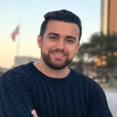

Researcher & Educator
Rami Tamimi focuses on integrating field surveying with advanced technologies like LiDAR and photogrammetry. With over a decade of experience in surveying, spanning land development and autonomous automotive technology. He leads the largest online surveying community on YouTube and founded The…


