
Mindy Li of XGRIDS argues that engineering-grade 3D data, captured with lidar as well as cameras, is the foundation of spatial intelligence, and shows how the same scans serve construction checks, BIM comparison, robot training and film pre-visualization. Mindy also announces the Lixel K2 compact handheld scanner, a free software update and LCC2, an open-sourced Gaussian splatting format that, according to Mindy, handles 150 million splats and already works with more than thirty ecosystem partners.
“Engineering grade trustworthy data are the foundation of spatial intelligence.”
“We open source it so that anyone, any developers can adopt it with measurement capability, annotation, 3D assets overlay, clipping and the relighting.”
“We have the new relationship between people, intelligent system, and the physical world.”
Yes. Mindy confirmed the software pipeline outputs point clouds, textured meshes and 3DGS, plus formats such as 3D Tiles and USDZ for tools like Revit and Unreal Engine.
No. Mindy said there is no plan to open-source the processing tools, which keep photos and lidar data aligned, but the LCC2 data format itself is open source so developers can adopt it.
According to Mindy, the L2 Pro already has a drone mount and also suits cars and larger sites, while the Lixel K2 is not designed for that scale.
Transcribed automatically (ElevenLabs Scribe) and lightly edited. It may contain small errors. Click a time to play the video from there.
Mindy Li: Yeah. Thank you. Hello, everyone. I'm very happy to be in Prague again. And thanks, Tomas and Michal, for inviting us and creating such an ins-inspiring place.
Mindy Li: And today, um, um, e-actually, I have a big announcement, but I still want to sharing as this topic. That's the works, uh, we all do, and it's connected with something that's much bigger. Before I start, um, quick check. Show off your hands who scanned last month and this week. Well, many of you.
Mindy Li: Really, many of you. And, um, s- many of you may scan also with XGRIDS scan, uh, scanners, I suppose. And I know that's you coming from all different kinds of industry, maybe AC, surveying, uh, filming, robotic simulation, as well as digital twins. You may have different standards for, um, even for what's enough good. But I suppose that we should do one same thing.
Mindy Li: You are all solving the same problem, turning the reality into something that understood, computed, and used. You walk into a space, level with the data, and someone downstream need to be trusted, trust it, and act on it. So, so that's the thing we called spatial intelligence. Maybe sometimes it sounds like a buzzword, but stay with me for a while. In the past ten years, AI has been good at, at two things, images and languages.
Mindy Li: However, uh, the, the things live in the 2D screen. But the 3D worlds, the worlds never doesn't make in, live in the 2D worlds. It has scale, geometry, as well as physics. If you watched a robot walk into a glass wa- a glass window or a generative video creates stairs with inspecif- in-impossible steps, you will know the gap between that. And, um, actually, you will know that gap between the 2D world and 3D world.
Mindy Li: What are the thing that we set layer for the spatial AI is the real world 3D data. And these days, let's see what's in practice. And this is two cases happening, Australian and Austria. In Australian, the mobile scanner has, uh, walk into a ten-minute site scanning and turn into point cloud. And with this, based on the verification, they got a two millimeter, a two hundred millimeter rebar standards.
Mindy Li: And in Austria, uh, we create BIM models, um, based on the reality capture datasets. And this is credit to Philipp in Austria. And then other than a spatial in, uh, other than a spatial measurement, we can also visualize with 3D Gaussian splats, just because in, it's not only captured with the visual sensor. It capture with data with lidar so that we get clean geometry. So you can overlay the datasets from different process, different phases, and compare it into different angles.
Mindy Li: And you can over-- uh, also overlay the BIM model with the reality to compare the difference between the design model with the reality and to see whether there is a difference or whether there is a, something needs to be modified. And other than the visualization, it can also turn into actionable datasets that can be anal, uh, analyzed and reasoning about. So when we put the design model into the real environment, you know exactly how it looks like, whether it's beautiful, whether it can fit in the environment. And you can also put into a, a interactive platform to make urban planning to see how many automobiles and people may pass by. So all these come to an conclusion.
Mindy Li: Engineering grade trustworthy data are the foundation of spatial intelligence. And let's jump into different industries. So other than the spatial e-measurement, we also want to adopt 3DGS in different kinds of scenarios, such as the robots. This case is coming from China. Uh, when a service robots come into the real site, they need to practice thousands of times in a robot gym.
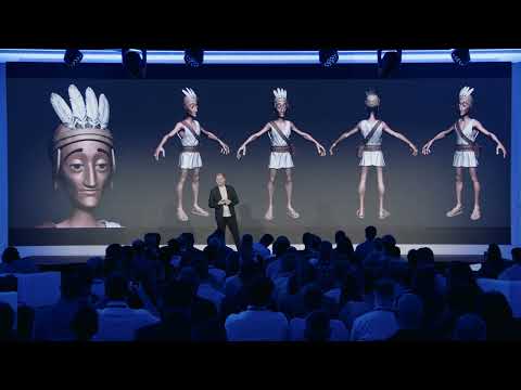
Mindy Li: And it works because the datasets is clear enough with the geometry without floating noise and the broken walls. And you, based on that, you can also labels structures, categorize them into different geometry and physics information so that it become the language the software computers can understand and recognizes. And the last case in this part, which is my favorite. Bi Gan is a Chinese director. His, um, film Resurrection win the special award in Cannes last year.
Mindy Li: There is a forty-five minute take, continuous take, one shoot, no cut. If you do a two minutes wonder before, you will know how hard it is. Every prop, every crew, every camera move, every lighting changes need to happen at same time. And this time, um, we capture the site with L2 Pro. And, um, in these pre-visualized- Uh, digital twins, and we can do the pre-visualization thousands of times before everyone-- before anyone can step into the site.
Mindy Li: Which means that thousands of times rehearsal, which burning the money and time, became a week of pre-visualization. And you can also use the 3D GS data assets for different stylish creation. And these digital sets always become a creation power. But, uh, when you see that more and more things has become the real pipelines, not only the demos, you may have the question, why isn't spatial intelligence as common as pulling out your phone? The question we've learned is that if we want to make spatial intelligence scale, it still have three walls.
Mindy Li: The first is that you must have engineering-grade fidelity. When you have the engineering-grade accurate datasets, you can only-- you can learn how the worlds, um, exist in geometry and the scale, correct scale. And the second is that multi-scenario adaptability, which means that you need to capture different scale datasets from outdoor to indoor, from the sky to the ground, multi-story buildings, tunnels, um, as well different kinds of larger scale parking lots. And third is that full workflow ecosystem, which means that you never want the scan stuck in your folders. You want them can be used in existing tools and pipelines.
Mindy Li: Here's what we learned from, um, different countries and industry scenarios. So actually my team is try to buildin- uh, building-- try to build a spatial intelligence platform. From the capture to the processing and application, the whole pipeline, um, c-conclude in spatial intelligence platform. And with handheld scanner and mobile scanning systems, you can capture the datasets much more easier. And when we get into the industry, people always come with the questions that how you use the data, not only just to view it, to measure it, you still need to get it into different pipelines with filming, documentation, digital twins, even the simulation of robots.
Mindy Li: And we also, uh, we always get to the challenges that how can make these technology become democratized in to-- and make it become accessible to more people more often. And here is today's my announcement and our answer to the question. The Lixel K2 is our answer. I'll be brief here, and I'd rather you to test it and, um, take it on hands, uh, and we will have a booth there, uh, rather than just a quick slide here. So several points with Lixel K2.
Mindy Li: It's lightweight, yet powerful. With one centimeter level accuracy, uh, it can get two, uh, point clouds, uh, and the different deliverables at same time. Point clouds, mesh models, as well 3D GS. And it has a good price point. Secondly, with one scan, after you finish the scan, you can directly transfer the datasets to the colleagues in the office, and you get a real-time data with clean, um, with clean curation.
Mindy Li: So we update it with the real-time object removal and filtering. So the data is really ready to use and can send to any one of the office to draw a 2D CAD drawings and BIM model. And also the mesh model is editable and shareable. Other than the hardware updates itself, it always meet the ecosystem and the pipeline standards. You can put the data into set, uh, put the dataset into Revit, AutoCAD for BIM model building, and you can also put the 3D GS result into the Omniverse Isaac Sim for simulation of the robots.
Mindy Li: And other than the embodied AI, we also provide all different kinds of tools for filming and gaming integration. And one thing is good for someone has already buy, uh, has already bought XGRIDS scanners. You get a free update with the software. The Lixel Studio four, which have four updates this time, better coloring even in low light, a better leveling even in a twenty-four multi-story buildings. And the filtering can get clean noise and still keep the structure.
Mindy Li: And meshes, it's texture meshes. In the past, we always output that mesh only for the collision purposes, but still we know that people still need that texture and meshes or different kinds of uses. So other than the one scan, multiple deliverables, one more thing we want to announce today is the LCC2, the format itself. Everyone use 3D GS not only in demo. We have a big wall ahead.
Mindy Li: You get the raw data very beautiful, but you cannot transfer it, you cannot share it in a very easy way, and sometimes it always lose the quality. So that's why we need to first compress it and then with the level of detail rendering strategy, and then you also-- we try to codex the storage and the sharing. So this point-- this video is, um, one hundred and fifty million splats. Compared with many of the systems, 3D GS systems, um, the limitation would be two million splats. Other than that, um, if you meet that limitations, you will see the splat not as beautiful as it was.
Mindy Li: And it also can walk and navigate in your cell phone. You can also try after that. And, uh, and the, the important thing is that we are not only make it like a black box, we are not only one to use it. We open source it so that anyone, any developers can adopt it with measurement capability, annotation, 3D assets overlay, clipping and the relighting. Whatever the things that you want to do, edited and analyzed with the models.
Mindy Li: And we've already built a deep integration with over thirty ecosystem partners, which means that you can not only visualize in the desktop in our software, you can directly input them into the workflow already exists. For example, the game engine like Unreal Engine, Unity, WebGL. And you can also use different editors to add it and change it and s- make it have different styles with SuperSplat, Arrival Space, Autodesk, and even within Esri, and you can have the 3D layers together with the 3DGS. And the Nucleus 4D and, uh, friends come from UK, Visus. All of them are our ecosystem partners that can adopt LCC2 at one moment, and you can also use them for different use cases.
Mindy Li: And let's see what we can create together. This is a real case rather than a demo. Uh, SBS in North Korea has already built the world's first AI XR studio so that they can use it for broadcasting through different scenes within one day. No need to drive from one place to another. And Fox has already adopted into their virtual production pipelines.
Mindy Li: Uh, with a documentary video, they scan the sites in the past times and added it into a new one. So they can project a 3DGS themes into the LED screen and volume to shoot eleven scenes within one day. We also have this one created by Christopher and, um, Arrival Space. So 3DGS is not a statistics data. It can be created with lighting and interaction, which is very immersive and interactive.
Mindy Li: And this one you will see. Other than you can also not only make people to read the datasets, view the datasets, and share the datasets, the robots can also learn and practice in thousands of, um, datasets we scanned, and they understand the world we live in, which is a black box for them. And not only one people, more and more people can also have a playable cities within a web br- web browser that you can share to any of your friend. So at the beginning of today's, uh, talk, I said that no matter you are in surveying, mea-- uh, spatial measurement, AEC industry, filming, and robots, we are doing the same thing, turning the spatial world into the datasets that people and machines can learn, understand, and recognize, and reason about. So that's not one thing for the efficiency enhancement for one industry.
Mindy Li: That's the relationship changes. We have the new relationship between people, intelligent system, and the physical world. At this moment, most of the syste- systems gather datasets but cannot really understand the spatial world, and that's the gap between the AI and the spatial intelligence. And the XGRIDS is building this platform to support the spatial intelligence f- to scale in a larger group of people. And, uh, thank you for coming with us and get to the gateway to the era of spatial intelligence.
Mindy Li: Thank you.
Host: Mindy Li. Thank you so much.
Mindy Li: Thank you.
Host: We still have time for the questions, and the questions did come through. Can we put them up on screen, please? And, um, Rami is asking, "What is the price of the new device that you presented?"
Mindy Li: Um, I cannot say a specific word, and you can also, uh, ask for the price list from our local dealer around the world. And I must say it's only, um, a little bit taller than the PortalCam. PortalCam is five thousand US dollars.
Host: Mm-hmm. So a bit more than that.
Mindy Li: It's more than that.
Host: Okay.
Mindy Li: But, um, affordable and a fair price.
Host: Okay. Thank you so much for sharing the estimate. Um, okay, moving on to the next one from Thilo. "So in the software pipeline, you can create 3D point cloud, textured mesh, and 3DGS?"
Mindy Li: Yes, exactly. So other than you can also, uh, input into like 3D tiles, uh, USDZ, so that you can input into different platforms and tools like Revit, Unreal Engine, and different, uh, tools that exist in your pipelines.
Host: Mm-hmm. Perfect. Um, "Mindy, uh, thanks for your amazing presentation," from Anis. Um, "In which extent or to which extent c-- now can we use XGRIDS to scan confined area/tunneling of ventilation with a big diameter?"
Mindy Li: Um-
Host: Uh, you can see the questions. I'm sorry.
Mindy Li: Uh-huh.
Host: Let me just, uh, just a second. Just a second. Yeah. You can see the question over there.
Mindy Li: Mm-hmm. In which extent now we can use XGRIDS to scan confined area tunneling of ventilation with a big diameter? Um, I think that, uh, uh, I, I don't know whether I understand these questions. Actually, we, we try to provide, um, versatile and a comprehensive solution that you can use different accessory to adapt into different, um, scenarios. For example, in confined area, Adam did a very good example that he just passed into a very narrow down tunnels with different people, and he passed the PortalCam one by one, which is the, the, the usage that I never imagined.
Mindy Li: And for larger areas, they may use like extension port harness system, and, uh, so the handheld scanner itself can adapt to different kind of scenarios and try to make it be much more, um, comprehensive.
Host: Mm-hmm. Thank you so much. Uh, next one. "Can I easily combine data from Lixel with other sources?"
Mindy Li: At this moment, you can combine the datasets with, um... We, we already have some examples that combine the Lixel datasets with the terrestrial laser scanners. And, uh, we also overlay the, um, 3D mesh with the Gaussian splats in, uh, not only SuperSplat, Arrival Space, but Unreal Engine.
Host: Mm-hmm. Uh, "Are you planning to take off from terrestrial and build a drone or drone payloads anytime soon?"
Mindy Li: Um, actually, we've already have a drone payload mount with L2 Pro, the system. Um, however, I think the compact, uh, scanner is not designed for that scale. And, uh, if you really need that scale, and, uh, we, we may recommend, highly rec- recommend that L2 Pro with longer walking range so that it can also mount on drone and car, uh, for larger scale cases.
Host: Mm-hmm. Perfect. And let's take the last one. Uh, "Do you plan to open, uh, source some of your processing tools?"
Mindy Li: Um, that's a very good question. People may always ask about whether you make it a black box. But I think the black box sometimes try to, uh, assure, uh, to make sure that the datasets is good enough with all the system and, uh, uh, photos, lidar data can be aligned together. So at this moment, we don't have the plan to, uh, open source the processing tools, but we open source the data format itself that developers can adopt, uh, adopt it into their pipelines very easily.
Host: Thank you so much. Ladies and gentlemen, Mindy Li.
Mindy Li: Thank you. Thank you so much.
Host: Thank you. Thanks so much.


Product Manager at XGRIDS
Being the Product Manager of Lixel CyberColor (LCC), a commercial-grade SLAM-based 3D Gaussian Splatting solution, Mindy Li is also in charge of XGRIDS global partnership with strong experience in spatial data capture and immersive 3D workflows, she helps bridge advanced scanning technology with…